Badarganj geodata
Badarganj (Rangpur Division) is a populated place; located in Bangladesh in Asia/Dhaka (GMT+6) time zone. With population of 32,600 people, there are 94 cities with bigger population in this country. Compared to other cities in Bangladesh, 94% of cities are located further ↓South; 85.5% of cities are located further →East and 94.9% of cities have lower elevation than Badarganj. Note1
Administrative division(s):
- Level 1: Rangpur Division
- Level 2: Rangpur
- Level 3: Badarganj Upazila
- Level 4: Badarganj


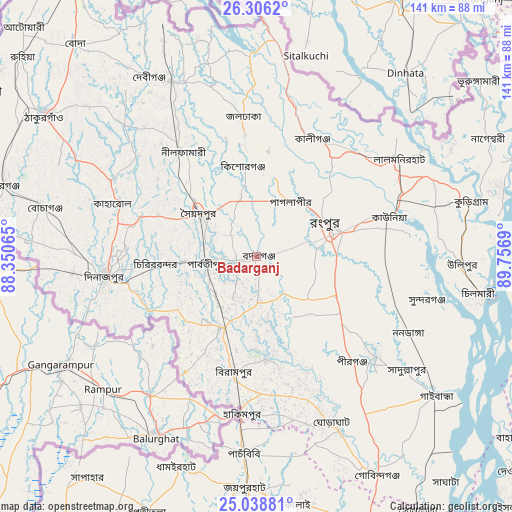
Badarganj GPS coordinates[2]
25° 40' 27.084" North, 89° 3' 13.572" East
| Map corner | latitude | longitude |
|---|---|---|
| Upper-left | 26.3062°, | 88.35065° |
| Center: | 25.67419°, | 89.05377° |
| Lower-right: | 25.03881°, | 89.7569° |
| Map W x H: | 140.9×140.9 km | = 87.6×87.6mi |
| max Lat: | 26.33338° ⇑6% North |
| Badarganj: | 25.67419° |
| min Lat: | ⇓94% South 20.85829° |
| min Long | Badarganj | max Long |
| 88.15638° | 89.05377° | 92.29773° |
| W 14.5%⇐ | ⇒85.5% E |
Elevation
Elevation of Badarganj is 40 m = 131 ft, and this is 22.1 m = 73 ft above average elevation for this country.
| Max E: |
79 m = 259 ft | 5.1% |
| Badarganj | 40 m 131 ft | |
| Avg. | 17.9 m = 59 ft | |
Min E: |
2 m = 7 ft | 94.9% |
See also: Bangladesh elevation on elevation.city.
Geographical zone
Badarganj is located in North temperate zone (between Tropic of Cancer and the Arctic Circle). Distance of this Northern Tropic circle is 248.8 km =154.6 mi to South.| Distance of | km | miles | from Badarganj |
|---|---|---|---|
| North Pole | 7152.4 | 4444.3 | to North |
| Arctic Circle | 4546.5 | 2825.1 | to North |
| Tropic Cancer | 248.8 | 154.6 | to South |
| Equator | 2854.7 | 1773.8 | to South |


Nearby cities:
15 places around Badarganj: (largest is in red/bold)
• Chilmāri
63.3 km =39.3 mi,  101°
101°
• Dinājpur
42 km =26.1 mi,  262°
262°
• Gaibandha
62.4 km =38.8 mi,  127°
127°
• Joypur Hāt
63.7 km =39.6 mi,  182°
182°
• Lalmonirhat
47.7 km =29.6 mi,  55°
55°
• Mahasthangarh
84.4 km =52.4 mi,  159°
159°
• Nageswari
71.7 km =44.6 mi, 62°
• Paharpur
72.4 km =45 mi,  186°
186°
• Panchagarh
88.5 km =55 mi,  325°
325°
• Parbatipur
12.4 km =7.7 mi, 264°
• Pīrgaaj
72.4 km =45 mi,  286°
286°
• Rangpur
21.4 km =13.3 mi,  67°
67°
• Saidpur
19.9 km =12.4 mi,  305°
305°
• Shibganj
79.5 km =49.4 mi, 160°
• Thākurgaon
70.6 km =43.9 mi,  304°
304°
Sources, notices
• [Note1] Compared only with cities in Bangladesh existing in our database
• [Src1] Map data: © OpenStreetMap contributors (CC-BY-SA)
• [Src2] Other city data from geonames.org with taken over terms of usage.
• [Src3] Geographical zone / Annual Mean Temperature by Robert A. Rohde @ Wikipedia
