Teknāf geodata
Teknāf (Chittagong) is a populated place; located in Bangladesh in Asia/Dhaka (GMT+6) time zone. With population of 40,557 people, there are 77 cities with bigger population in this country. Compared to other cities in Bangladesh, 100% of cities are located further ↑North; 100% of cities are located further ←West and 98.3% of cities have higher elevation than Teknāf. Note1
Administrative division(s):
- Level 1: Chittagong
- Level 2: Cox's Bazar
- Level 3: Teknaf
- Level 4: Teknaf


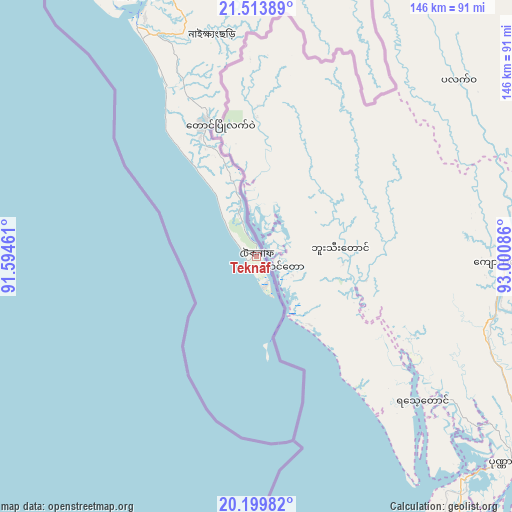
Teknāf GPS coordinates[2]
20° 51' 29.844" North, 92° 17' 51.828" East
| Map corner | latitude | longitude |
|---|---|---|
| Upper-left | 21.51389°, | 91.59461° |
| Center: | 20.85829°, | 92.29773° |
| Lower-right: | 20.19982°, | 93.00086° |
| Map W x H: | 146.1×146.1 km | = 90.8×90.8mi |
| max Lat: | 26.33338° ⇑100% North |
| Teknāf: | 20.85829° |
| min Lat: | ⇓0% South 20.85829° |
| min Long | Teknāf | max Long |
| 88.15638° | 92.29773° | 92.29773° |
| W 100%⇐ | ⇒0% E |
Elevation
Elevation of Teknāf is 7 m = 23 ft, and this is 10.9 m = 36 ft below average elevation for this country.
| Max E: |
79 m = 259 ft | 98.3% |
| Avg. | 17.9 m = 59 ft | |
| Teknāf | 7 m = 23 ft | |
Min E: |
2 m = 7 ft | 1.7% |
See also: Teknāf elevation on elevation.city.
Geographical zone
Teknāf is located in North Torrid zone (between Equator and Tropic of Cancer). Distance of this Northern Tropic circle is 286.7 km =178.1 mi to North.| Distance of | km | miles | from Teknāf |
|---|---|---|---|
| North Pole | 7687.8 | 4777 | to North |
| Arctic Circle | 5081.9 | 3157.7 | to North |
| Tropic Cancer | 286.7 | 178.1 | to North |
| Equator | 2319.2 | 1441.1 | to South |


Nearby cities:
15 places around Teknāf: (largest is in red/bold)
• Bibir Hat
209.6 km =130.2 mi,  345°
345°
• Burhānuddin
244.1 km =151.7 mi,  318°
318°
• Bāndarban
148.9 km =92.5 mi,  356°
356°
• Chhāgalnāiya
254.2 km =158 mi,  341°
341°
• Chittagong
171.5 km =106.6 mi, 343°
• Cox’s Bāzār
71.2 km =44.2 mi, 335°
• Feni
257.1 km =159.8 mi, 338°
• Khagrachhari
252.4 km =156.8 mi, 352°
• Lālmohan
230.4 km =143.2 mi, 315°
• Manikchari
225.3 km =140 mi, 347°
• Patiya
163.2 km =101.4 mi, 348°
• Raojān
190.5 km =118.4 mi, 348°
• Sandwīp
203.7 km =126.6 mi,  334°
334°
• Sātkania
137.9 km =85.7 mi, 349°
• Uttar Char Fasson
223.6 km =138.9 mi,  312°
312°
Sources, notices
• [Note1] Compared only with cities in Bangladesh existing in our database
• [Src1] Map data: © OpenStreetMap contributors (CC-BY-SA)
• [Src2] Other city data from geonames.org with taken over terms of usage.
• [Src3] Geographical zone / Annual Mean Temperature by Robert A. Rohde @ Wikipedia
