Cox’s Bāzār geodata
Cox’s Bāzār (Chittagong) is a populated place; located in Bangladesh in Asia/Dhaka (GMT+6) time zone. With population of 253,788 people, there are 11 cities with bigger population in this country. Compared to other cities in Bangladesh, 99.1% of cities are located further ↑North; 97.4% of cities are located further ←West and 100% of cities have higher elevation than Cox’s Bāzār. Note1
Administrative division(s):
- Level 1: Chittagong
- Level 2: Cox's Bazar
- Level 3: Cox's Bazar Sadar Upazila
- Level 4: Jhilwanja


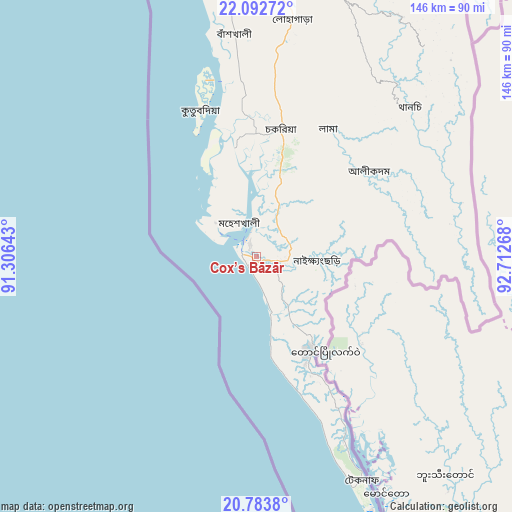
Cox’s Bāzār GPS coordinates[2]
21° 26' 23.028" North, 92° 0' 34.38" East
| Map corner | latitude | longitude |
|---|---|---|
| Upper-left | 22.09272°, | 91.30643° |
| Center: | 21.43973°, | 92.00955° |
| Lower-right: | 20.7838°, | 92.71268° |
| Map W x H: | 145.5×145.5 km | = 90.4×90.4mi |
| max Lat: | 26.33338° ⇑99.1% North |
| Cox’s Bāzār: | 21.43973° |
| min Lat: | ⇓0.9% South 20.85829° |
| min Long | Cox’s Bāzār | max Long |
| 88.15638° | 92.00955° | 92.29773° |
| W 97.4%⇐ | ⇒2.6% E |
Elevation
Elevation of Cox’s Bāzār is 2 m = 7 ft, and this is 15.9 m = 52 ft below average elevation for this country.
| Max E: |
79 m = 259 ft | 100% |
| Avg. | 17.9 m = 59 ft | |
| Cox’s Bāzār | 2 m = 7 ft | |
Min E: |
2 m = 7 ft | 0% |
See also: Cox’s Bāzār elevation on elevation.city.
Geographical zone
Cox’s Bāzār is located in North Torrid zone (between Equator and Tropic of Cancer). Distance of this Northern Tropic circle is 222 km =137.9 mi to North.| Distance of | km | miles | from Cox’s Bāzār |
|---|---|---|---|
| North Pole | 7623.2 | 4736.8 | to North |
| Arctic Circle | 5017.3 | 3117.6 | to North |
| Tropic Cancer | 222 | 137.9 | to North |
| Equator | 2383.9 | 1481.3 | to South |


Nearby cities:
15 places around Cox’s Bāzār: (largest is in red/bold)
• Bibir Hat
140.1 km =87.1 mi,  350°
350°
• Burhānuddin
177 km =110 mi,  311°
311°
• Bāndarban
86.8 km =53.9 mi,  14°
14°
• Chhāgalnāiya
183.6 km =114.1 mi,  343°
343°
• Chittagong
101.6 km =63.1 mi, 349°
• Feni
186.1 km =115.6 mi, 340°
• Khagrachhari
185.5 km =115.3 mi,  358°
358°
• Lālmohan
164.9 km =102.5 mi, 307°
• Manikchari
156.6 km =97.3 mi, 353°
• Patiya
95.2 km =59.2 mi, 358°
• Raojān
122.2 km =75.9 mi, 355°
• Sandwīp
132.4 km =82.3 mi,  334°
334°
• Sātkania
70.9 km =44.1 mi,  3°
3°
• Teknāf
71.2 km =44.2 mi,  155°
155°
• Uttar Char Fasson
159.9 km =99.4 mi,  303°
303°
Sources, notices
• [Note1] Compared only with cities in Bangladesh existing in our database
• [Src1] Map data: © OpenStreetMap contributors (CC-BY-SA)
• [Src2] Other city data from geonames.org with taken over terms of usage.
• [Src3] Geographical zone / Annual Mean Temperature by Robert A. Rohde @ Wikipedia
