Uttar Char Fasson geodata
Uttar Char Fasson (Khulna) is a populated place; located in Bangladesh in Asia/Dhaka (GMT+6) time zone. With population of 48,305 people, there are 66 cities with bigger population in this country. Compared to other cities in Bangladesh, 96.6% of cities are located further ↑North; 71.8% of cities are located further ←West and 98.3% of cities have higher elevation than Uttar Char Fasson. Note1


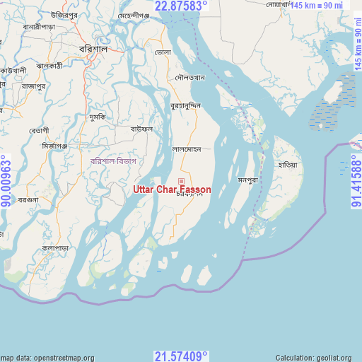
Uttar Char Fasson GPS coordinates[2]
22° 13' 35.292" North, 90° 42' 45.9" East
| Map corner | latitude | longitude |
|---|---|---|
| Upper-left | 22.87583°, | 90.00963° |
| Center: | 22.22647°, | 90.71275° |
| Lower-right: | 21.57409°, | 91.41588° |
| Map W x H: | 144.7×144.7 km | = 89.9×89.9mi |
| max Lat: | 26.33338° ⇑96.6% North |
| Uttar Char Fasson: | 22.22647° |
| min Lat: | ⇓3.4% South 20.85829° |
| min Long | Uttar Char Fass | max Long |
| 88.15638° | 90.71275° | 92.29773° |
| W 71.8%⇐ | ⇒28.2% E |
Elevation
Elevation of Uttar Char Fasson is 7 m = 23 ft, and this is 10.9 m = 36 ft below average elevation for this country.
| Max E: |
79 m = 259 ft | 98.3% |
| Avg. | 17.9 m = 59 ft | |
| Uttar Char Fasson | 7 m = 23 ft | |
Min E: |
2 m = 7 ft | 1.7% |
See also: Uttar Char Fasson elevation on elevation.city.
Geographical zone
Uttar Char Fasson is located in North Torrid zone (between Equator and Tropic of Cancer). Distance of this Northern Tropic circle is 134.6 km =83.6 mi to North.| Distance of | km | miles | from Uttar Char Fasson |
|---|---|---|---|
| North Pole | 7535.7 | 4682.5 | to North |
| Arctic Circle | 4929.8 | 3063.2 | to North |
| Tropic Cancer | 134.6 | 83.6 | to North |
| Equator | 2471.4 | 1535.7 | to South |


Nearby cities:
15 places around Uttar Char Fasson: (largest is in red/bold)
• Barisāl
63.8 km =39.6 mi,  326°
326°
• Bhola
51.8 km =32.2 mi,  352°
352°
• Bhāndāria
72.9 km =45.3 mi,  293°
293°
• Burhānuddin
29.9 km =18.6 mi,  2°
2°
• Gaurnadi
97.1 km =60.3 mi, 328°
• Lakshmīpur
80.7 km =50.1 mi,  8°
8°
• Lālmohan
12.6 km =7.8 mi, 11°
• Mathba
77.9 km =48.4 mi,  274°
274°
• Mehendiganj
68.9 km =42.8 mi,  344°
344°
• Morrelgonj
91.7 km =57 mi, 286°
• Nālchiti
64.3 km =40 mi,  315°
315°
• Pirojpur
85.4 km =53.1 mi,  297°
297°
• Rāipur
90.5 km =56.2 mi, 3°
• Sandwīp
82.7 km =51.4 mi,  67°
67°
• Sarankhola
95.3 km =59.2 mi,  275°
275°
Sources, notices
• [Note1] Compared only with cities in Bangladesh existing in our database
• [Src1] Map data: © OpenStreetMap contributors (CC-BY-SA)
• [Src2] Other city data from geonames.org with taken over terms of usage.
• [Src3] Geographical zone / Annual Mean Temperature by Robert A. Rohde @ Wikipedia
