Maulavi Bāzār geodata
Maulavi Bāzār (Sylhet) is a populated place; located in Bangladesh in Asia/Dhaka (GMT+6) time zone. With population of 57,441 people, there are 54 cities with bigger population in this country. Compared to other cities in Bangladesh, 73.5% of cities are located further ↓South; 90.6% of cities are located further ←West and 66.7% of cities have lower elevation than Maulavi Bāzār. Note1
Administrative division(s):
- Level 1: Sylhet
- Level 2: Maulvibazar
- Level 3: Moulvibazar Sadar Upazila
- Level 4: Paurashava


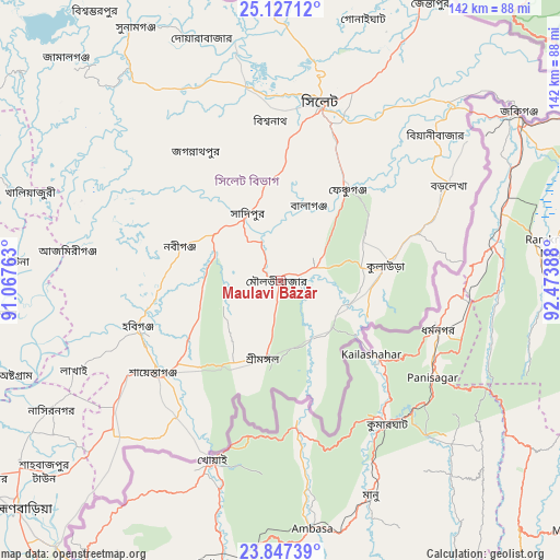
Maulavi Bāzār GPS coordinates[2]
24° 29' 19.968" North, 91° 46' 14.7" East
| Map corner | latitude | longitude |
|---|---|---|
| Upper-left | 25.12712°, | 91.06763° |
| Center: | 24.48888°, | 91.77075° |
| Lower-right: | 23.84739°, | 92.47388° |
| Map W x H: | 142.3×142.3 km | = 88.4×88.4mi |
| max Lat: | 26.33338° ⇑26.5% North |
| Maulavi Bāzār: | 24.48888° |
| min Lat: | ⇓73.5% South 20.85829° |
| min Long | Maulavi Bāzār | max Long |
| 88.15638° | 91.77075° | 92.29773° |
| W 90.6%⇐ | ⇒9.4% E |
Elevation
Elevation of Maulavi Bāzār is 19 m = 62 ft, and this is 1.1 m = 4 ft above average elevation for this country.
| Max E: |
79 m = 259 ft | 33.3% |
| Maulavi Bāzār | 19 m 62 ft | |
| Avg. | 17.9 m = 59 ft | |
Min E: |
2 m = 7 ft | 66.7% |
See also: Maulavi Bāzār elevation on elevation.city.
Geographical zone
Maulavi Bāzār is located in North temperate zone (between Tropic of Cancer and the Arctic Circle). Distance of this Northern Tropic circle is 117 km =72.7 mi to South.| Distance of | km | miles | from Maulavi Bāzār |
|---|---|---|---|
| North Pole | 7284.2 | 4526.2 | to North |
| Arctic Circle | 4678.3 | 2907 | to North |
| Tropic Cancer | 117 | 72.7 | to South |
| Equator | 2722.9 | 1691.9 | to South |


Nearby cities:
15 places around Maulavi Bāzār: (largest is in red/bold)
• Baniachang
41.9 km =26 mi,  274°
274°
• Bhairab Bāzār
94 km =58.4 mi,  238°
238°
• Bājitpur
88.5 km =55 mi,  249°
249°
• Chhātak
62 km =38.5 mi,  350°
350°
• Comilla
128.8 km =80 mi,  207°
207°
• Gafargaon
122.9 km =76.4 mi, 267°
• Habiganj
38.2 km =23.7 mi, 251°
• Jahedpur
40.2 km =25 mi,  342°
342°
• Kishorganj
100.1 km =62.2 mi, 266°
• Mymensingh
141.1 km =87.7 mi,  282°
282°
• Nabīnagar
105.3 km =65.4 mi,  230°
230°
• Narsingdi
124 km =77.1 mi, 239°
• Netrakona
114 km =70.8 mi,  292°
292°
• Purbadhala
128.5 km =79.8 mi, 293°
• Sylhet
46.7 km =29 mi,  12°
12°
Sources, notices
• [Note1] Compared only with cities in Bangladesh existing in our database
• [Src1] Map data: © OpenStreetMap contributors (CC-BY-SA)
• [Src2] Other city data from geonames.org with taken over terms of usage.
• [Src3] Geographical zone / Annual Mean Temperature by Robert A. Rohde @ Wikipedia
