Chhātak geodata
Chhātak (Sylhet) is a seat of a third-order administrative division; located in Bangladesh in Asia/Dhaka (GMT+6) time zone. With population of 39,218 people, there are 83 cities with bigger population in this country. Compared to other cities in Bangladesh, 88.9% of cities are located further ↓South; 89.7% of cities are located further ←West and 62.4% of cities have lower elevation than Chhātak. Note1


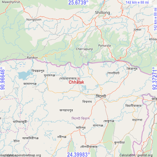
Chhātak GPS coordinates[2]
25° 2' 18.672" North, 91° 40' 10.488" East
| Map corner | latitude | longitude |
|---|---|---|
| Upper-left | 25.6739°, | 90.96646° |
| Center: | 25.03852°, | 91.66958° |
| Lower-right: | 24.39983°, | 92.37271° |
| Map W x H: | 141.7×141.7 km | = 88×88mi |
| max Lat: | 26.33338° ⇑11.1% North |
| Chhātak: | 25.03852° |
| min Lat: | ⇓88.9% South 20.85829° |
| min Long | Chhātak | max Long |
| 88.15638° | 91.66958° | 92.29773° |
| W 89.7%⇐ | ⇒10.3% E |
Elevation
Elevation of Chhātak is 17 m = 56 ft, and this is 0.9 m = 3 ft below average elevation for this country.
| Max E: |
79 m = 259 ft | 37.6% |
| Avg. | 17.9 m = 59 ft | |
| Chhātak | 17 m = 56 ft | |
Min E: |
2 m = 7 ft | 62.4% |
See also: Bangladesh elevation on elevation.city.
Geographical zone
Chhātak is located in North temperate zone (between Tropic of Cancer and the Arctic Circle). Distance of this Northern Tropic circle is 178.1 km =110.7 mi to South.| Distance of | km | miles | from Chhātak |
|---|---|---|---|
| North Pole | 7223 | 4488.2 | to North |
| Arctic Circle | 4617.2 | 2869 | to North |
| Tropic Cancer | 178.1 | 110.7 | to South |
| Equator | 2784 | 1729.9 | to South |


Nearby cities:
15 places around Chhātak: (largest is in red/bold)
• Baniachang
65.8 km =40.9 mi,  208°
208°
• Bhairab Bāzār
130.1 km =80.8 mi, 212°
• Bājitpur
116.8 km =72.6 mi,  218°
218°
• Gafargaon
130.9 km =81.3 mi,  238°
238°
• Habiganj
77.6 km =48.2 mi,  199°
199°
• Jahedpur
22.9 km =14.2 mi,  184°
184°
• Kishorganj
111.6 km =69.3 mi,  233°
233°
• Maulavi Bāzār
62 km =38.5 mi,  170°
170°
• Muktāgācha
145.7 km =90.5 mi,  257°
257°
• Mymensingh
131.2 km =81.5 mi, 256°
• Nabīnagar
146.3 km =90.9 mi, 209°
• Narsingdi
157 km =97.6 mi, 217°
• Netrakona
96.4 km =59.9 mi, 259°
• Purbadhala
108.3 km =67.3 mi, 264°
• Sylhet
25.6 km =15.9 mi,  127°
127°
Sources, notices
• [Note1] Compared only with cities in Bangladesh existing in our database
• [Src1] Map data: © OpenStreetMap contributors (CC-BY-SA)
• [Src2] Other city data from geonames.org with taken over terms of usage.
• [Src3] Geographical zone / Annual Mean Temperature by Robert A. Rohde @ Wikipedia
