Geel geodata
Geel (Flanders) is a populated place; located in Belgium in Europe/Brussels (GMT+2) time zone. With population of 34,697 people, there are 40 cities with bigger population in this country. Compared to other cities in Belgium, 87.2% of cities are located further ↓South; 65.5% of cities are located further ←West and 70% of cities have higher elevation than Geel. Note1
Administrative division(s):
- Level 1: Flanders
- Level 2: Provincie Antwerpen
- Level 3: Arrondissement Turnhout
- Level 4: Geel


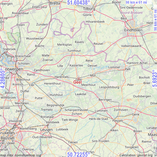
Geel GPS coordinates[2]
51° 9' 56.052" North, 4° 59' 21.012" East
| Map corner | latitude | longitude |
|---|---|---|
| Upper-left | 51.60438°, | 4.28605° |
| Center: | 51.16557°, | 4.98917° |
| Lower-right: | 50.72255°, | 5.6923° |
| Map W x H: | 98.1×98 km | = 61×60.9mi |
| max Lat: | 51.46791° ⇑12.8% North |
| Geel: | 51.16557° |
| min Lat: | ⇓87.2% South 49.53771° |
| min Long | Geel | max Long |
| 2.59368° | 4.98917° | 6.25749° |
| W 65.5%⇐ | ⇒34.5% E |
Elevation
Elevation of Geel is 22 m = 72 ft, and this is 77.5 m = 254 ft below average elevation for this country.
| Max E: |
582 m = 1909 ft | 70% |
| Avg. | 99.5 m = 326 ft | |
| Geel | 22 m = 72 ft | |
Min E: |
1 m = 3 ft | 30% |
See also: Belgium elevation on elevation.city.
Geographical zone
Geel is located in North temperate zone (between Tropic of Cancer and the Arctic Circle). Distance of this North polar circle is 1712.1 km =1063.8 mi to North.| Distance of | km | miles | from Geel |
|---|---|---|---|
| North Pole | 4318 | 2683.1 | to North |
| Arctic Circle | 1712.1 | 1063.8 | to North |
| Tropic Cancer | 3083.2 | 1915.8 | to South |
| Equator | 5689.1 | 3535 | to South |


Nearby cities:
15 places around Geel: (largest is in red/bold)
• Balen
12.6 km =7.8 mi,  88°
88°
• Dessel
11.9 km =7.4 mi,  47°
47°
• Herentals
11 km =6.8 mi,  276°
276°
• Herenthout
16.5 km =10.3 mi,  260°
260°
• Herselt
14.7 km =9.1 mi,  210°
210°
• Kasterlee
8.6 km =5.3 mi,  349°
349°
• Laakdal
9.5 km =5.9 mi,  173°
173°
• Lille
14.4 km =8.9 mi,  306°
306°
• Meerhout
7.3 km =4.5 mi,  120°
120°
• Mol
9.4 km =5.8 mi,  71°
71°
• Olen
9.3 km =5.8 mi, 255°
• Retie
13 km =8.1 mi,  30°
30°
• Tessenderlo
13.1 km =8.1 mi,  148°
148°
• Vorselaar
15.6 km =9.7 mi,  285°
285°
• Westerlo
9.8 km =6.1 mi, 211°
Sources, notices
• [Note1] Compared only with cities in Belgium existing in our database
• [Src1] Map data: © OpenStreetMap contributors (CC-BY-SA)
• [Src2] Other city data from geonames.org with taken over terms of usage.
• [Src3] Geographical zone / Annual Mean Temperature by Robert A. Rohde @ Wikipedia
