Lagoa Vermelha geodata
Lagoa Vermelha (Rio Grande do Sul) is a populated place; located in Brazil in America/Sao_Paulo (GMT-3) time zone. With population of 24,445 people, there are 795 cities with bigger population in this country. Compared to other cities in Brazil, 94.2% of cities are located further ↑North; 85.7% of cities are located further →East and 88.6% of cities have lower elevation than Lagoa Vermelha. Note1


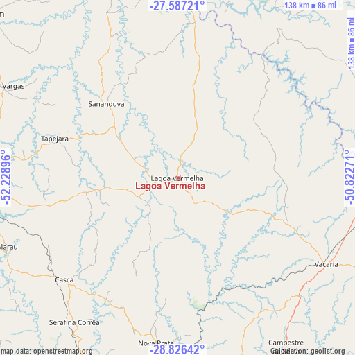
Lagoa Vermelha GPS coordinates[2]
28° 12' 30.996" South, 51° 31' 32.988" West
| Map corner | latitude | longitude |
|---|---|---|
| Upper-left | -27.58721°, | -52.22896° |
| Center: | -28.20861°, | -51.52583° |
| Lower-right: | -28.82642°, | -50.82271° |
| Map W x H: | 137.8×137.8 km | = 85.6×85.6mi |
| max Lat: | 2.81972° ⇑94.2% North |
| Lagoa Vermelha: | -28.20861° |
| min Lat: | ⇓5.8% South -33.69111° |
| min Long | Lagoa Vermelha | max Long |
| -72.89583° | -51.52583° | -32.41083° |
| W 14.3%⇐ | ⇒85.7% E |
Elevation
Elevation of Lagoa Vermelha is 793 m = 2602 ft, and this is 412.1 m = 1352 ft above average elevation for this country.
| Max E: |
1603 m = 5259 ft | 11.4% |
| Lagoa Vermelha | 793 m 2602 ft | |
| Avg. | 380.9 m = 1250 ft | |
Min E: |
0 m = 0 ft | 88.6% |
See also: Brazil elevation on elevation.city.
Geographical zone
Lagoa Vermelha is located in South temperate zone (between Tropic of Capricorn and the Antarctic Circle). Distance of this Southern Tropic circle is 530.6 km =329.7 mi to North.| Distance of | km | miles | from Lagoa Vermelha |
|---|---|---|---|
| Equator | 3136.5 | 1948.9 | to North |
| Tropic Capricorn | 530.6 | 329.7 | to North |
| Antarctic Circle | 4264.7 | 2650 | to South |
| South Pole | 6870.6 | 4269.2 | to South |


Nearby cities:
15 places around Lagoa Vermelha: (largest is in red/bold)
• Campos Novos
94.5 km =58.7 mi,  18°
18°
• Capinzal
96.6 km =60 mi,  354°
354°
• Celso Ramos
66.5 km =41.3 mi, 16°
• Erechim
97.4 km =60.5 mi,  310°
310°
• Estrela
59.9 km =37.2 mi,  74°
74°
• Flores da Cunha
97.2 km =60.4 mi,  159°
159°
• Guaporé
79.3 km =49.3 mi,  206°
206°
• Marau
71.2 km =44.2 mi,  247°
247°
• Nova Prata
64.5 km =40.1 mi,  187°
187°
• Passo Fundo
86.5 km =53.7 mi,  266°
266°
• Sananduva
39.8 km =24.7 mi,  316°
316°
• São Marcos
95.8 km =59.5 mi,  152°
152°
• Tapejara
50.3 km =31.3 mi,  288°
288°
• Vacaria
67 km =41.6 mi,  120°
120°
• Veranópolis
80.9 km =50.3 mi,  181°
181°
Sources, notices
• [Note1] Compared only with cities in Brazil existing in our database
• [Src1] Map data: © OpenStreetMap contributors (CC-BY-SA)
• [Src2] Other city data from geonames.org with taken over terms of usage.
• [Src3] Geographical zone / Annual Mean Temperature by Robert A. Rohde @ Wikipedia
