Ubatuba geodata
Ubatuba (São Paulo) is a seat of a second-order administrative division; located in Brazil in America/Sao_Paulo (GMT-3) time zone. With population of 79,007 people, there are 289 cities with bigger population in this country. Compared to other cities in Brazil, 82.2% of cities are located further ↑North; 51% of cities are located further ←West and 98.3% of cities have higher elevation than Ubatuba. Note1


Ubatuba GPS coordinates[2]
23° 26' 2.004" South, 45° 4' 15.996" West
| Map corner | latitude | longitude |
|---|---|---|
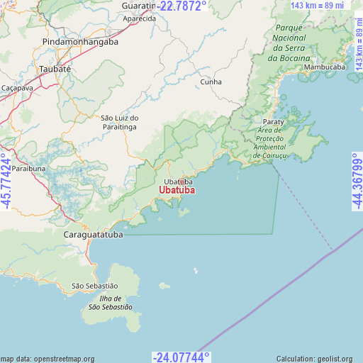
| Upper-left | -22.7872°, | -45.77424° |
| Center: | -23.43389°, | -45.07111° |
| Lower-right: | -24.07744°, | -44.36799° |
| Map W x H: | 143.5×143.5 km | = 89.2×89.2mi |
| max Lat: | 2.81972° ⇑82.2% North |
| Ubatuba: | -23.43389° |
| min Lat: | ⇓17.8% South -33.69111° |
| min Long | Ubatuba | max Long |
| -72.89583° | -45.07111° | -32.41083° |
| W 51%⇐ | ⇒49% E |
Elevation
Elevation of Ubatuba is 6 m = 20 ft, and this is 374.9 m = 1230 ft below average elevation for this country.
| Max E: |
1603 m = 5259 ft | 98.3% |
| Avg. | 380.9 m = 1250 ft | |
| Ubatuba | 6 m = 20 ft | |
Min E: |
0 m = 0 ft | 1.7% |
See also: Ubatuba elevation on elevation.city.
Geographical zone
Ubatuba is located in South Torrid zone (between Equator and Tropic of Capricorn). Distance of this Southern Tropic circle is 0.3 km =0.2 mi to South.| Distance of | km | miles | from Ubatuba |
|---|---|---|---|
| Equator | 2605.6 | 1619 | to North |
| Tropic Capricorn | 0.3 | 0.2 | to South |
| Antarctic Circle | 4795.6 | 2979.8 | to South |
| South Pole | 7401.5 | 4599.1 | to South |


Nearby cities:
15 places around Ubatuba: (largest is in red/bold)
• Angra dos Reis
90.4 km =56.2 mi,  58°
58°
• Aparecida
67.2 km =41.8 mi,  346°
346°
• Caraguatatuba
40.6 km =25.2 mi,  239°
239°
• Caçapava
74.8 km =46.5 mi,  299°
299°
• Cunha
41.6 km =25.8 mi,  15°
15°
• Guaratinguetá
69.8 km =43.4 mi, 349°
• Ilhabela
48.2 km =30 mi,  217°
217°
• Lorena
78.4 km =48.7 mi,  355°
355°
• Paraty
43.7 km =27.2 mi, 56°
• Pindamonhangaba
69.3 km =43.1 mi,  324°
324°
• Santa Branca
83 km =51.6 mi,  272°
272°
• São José dos Campos
88 km =54.7 mi,  288°
288°
• São Sebastião
50.1 km =31.1 mi, 223°
• Taubaté
67.1 km =41.7 mi,  312°
312°
• Tremembé
72 km =44.7 mi, 317°
Sources, notices
• [Note1] Compared only with cities in Brazil existing in our database
• [Src1] Map data: © OpenStreetMap contributors (CC-BY-SA)
• [Src2] Other city data from geonames.org with taken over terms of usage.
• [Src3] Geographical zone / Annual Mean Temperature by Robert A. Rohde @ Wikipedia
