Paranaíba geodata
Paranaíba (Mato Grosso do Sul) is a populated place; located in Brazil in America/Campo_Grande (GMT-4) time zone. With population of 32,217 people, there are 631 cities with bigger population in this country. Compared to other cities in Brazil, 55.2% of cities are located further ↑North; 84% of cities are located further →East and 52.5% of cities have lower elevation than Paranaíba. Note1


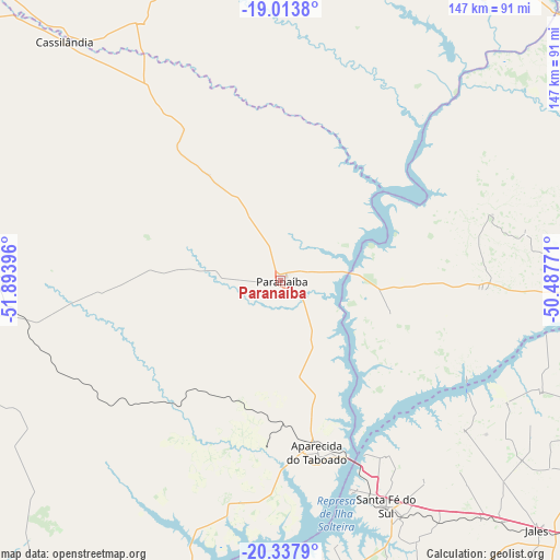
Paranaíba GPS coordinates[2]
19° 40' 37.992" South, 51° 11' 26.988" West
| Map corner | latitude | longitude |
|---|---|---|
| Upper-left | -19.0138°, | -51.89396° |
| Center: | -19.67722°, | -51.19083° |
| Lower-right: | -20.3379°, | -50.48771° |
| Map W x H: | 147.2×147.2 km | = 91.5×91.5mi |
| max Lat: | 2.81972° ⇑55.2% North |
| Paranaíba: | -19.67722° |
| min Lat: | ⇓44.8% South -33.69111° |
| min Long | Paranaíba | max Long |
| -72.89583° | -51.19083° | -32.41083° |
| W 16%⇐ | ⇒84% E |
Elevation
Elevation of Paranaíba is 383 m = 1257 ft, and this is 2.1 m = 7 ft above average elevation for this country.
| Max E: |
1603 m = 5259 ft | 47.5% |
| Paranaíba | 383 m 1257 ft | |
| Avg. | 380.9 m = 1250 ft | |
Min E: |
0 m = 0 ft | 52.5% |
See also: Brazil elevation on elevation.city.
Geographical zone
Paranaíba is located in South Torrid zone (between Equator and Tropic of Capricorn). Distance of this Southern Tropic circle is 418 km =259.7 mi to South.| Distance of | km | miles | from Paranaíba |
|---|---|---|---|
| Equator | 2187.9 | 1359.5 | to North |
| Tropic Capricorn | 418 | 259.7 | to South |
| Antarctic Circle | 5213.3 | 3239.4 | to South |
| South Pole | 7819.2 | 4858.6 | to South |


Nearby cities:
15 places around Paranaíba: (largest is in red/bold)
• Andradina
136.9 km =85.1 mi,  188°
188°
• Aparecida do Taboado
46.6 km =29 mi,  167°
167°
• Auriflama
130.3 km =81 mi,  149°
149°
• Cardoso
140.9 km =87.6 mi,  108°
108°
• Cassilândia
84.7 km =52.6 mi,  317°
317°
• Castilho
136.4 km =84.8 mi, 193°
• Caçu
124.8 km =77.5 mi,  2°
2°
• Fernandópolis
119.5 km =74.3 mi,  124°
124°
• General Salgado
138.5 km =86.1 mi,  141°
141°
• Ilha Solteira
85.5 km =53.1 mi, 190°
• Iturama
104.3 km =64.8 mi,  93°
93°
• Jales
94.2 km =58.5 mi,  134°
134°
• Pereira Barreto
107.2 km =66.6 mi,  175°
175°
• Santa Fé do Sul
65.5 km =40.7 mi, 154°
• Três Lagoas
134.6 km =83.6 mi,  203°
203°
Sources, notices
• [Note1] Compared only with cities in Brazil existing in our database
• [Src1] Map data: © OpenStreetMap contributors (CC-BY-SA)
• [Src2] Other city data from geonames.org with taken over terms of usage.
• [Src3] Geographical zone / Annual Mean Temperature by Robert A. Rohde @ Wikipedia
