Mascote geodata
Mascote (Bahia) is a populated place; located in Brazil in America/Bahia (GMT-3) time zone. With population of 18,863 people, there are 988 cities with bigger population in this country. Compared to other cities in Brazil, 54.8% of cities are located further ↓South; 78.4% of cities are located further ←West and 78.2% of cities have higher elevation than Mascote. Note1


Mascote GPS coordinates[2]
15° 33' 47.016" South, 39° 18' 9" West
| Map corner | latitude | longitude |
|---|---|---|
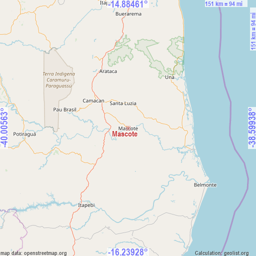
| Upper-left | -14.88461°, | -40.00563° |
| Center: | -15.56306°, | -39.3025° |
| Lower-right: | -16.23928°, | -38.59938° |
| Map W x H: | 150.6×150.6 km | = 93.6×93.6mi |
| max Lat: | 2.81972° ⇑45.2% North |
| Mascote: | -15.56306° |
| min Lat: | ⇓54.8% South -33.69111° |
| min Long | Mascote | max Long |
| -72.89583° | -39.3025° | -32.41083° |
| W 78.4%⇐ | ⇒21.6% E |
Elevation
Elevation of Mascote is 56 m = 184 ft, and this is 324.9 m = 1066 ft below average elevation for this country.
| Max E: |
1603 m = 5259 ft | 78.2% |
| Avg. | 380.9 m = 1250 ft | |
| Mascote | 56 m = 184 ft | |
Min E: |
0 m = 0 ft | 21.8% |
See also: Brazil elevation on elevation.city.
Geographical zone
Mascote is located in South Torrid zone (between Equator and Tropic of Capricorn). Distance of this Southern Tropic circle is 875.5 km =544 mi to South.| Distance of | km | miles | from Mascote |
|---|---|---|---|
| Equator | 1730.5 | 1075.3 | to North |
| Tropic Capricorn | 875.5 | 544 | to South |
| Antarctic Circle | 5670.7 | 3523.6 | to South |
| South Pole | 8276.6 | 5142.8 | to South |


Nearby cities:
15 places around Mascote: (largest is in red/bold)
• Belmonte
56.1 km =34.9 mi,  126°
126°
• Buerarema
67.1 km =41.7 mi,  0°
0°
• Canavieiras
40 km =24.9 mi,  108°
108°
• Coaraci
106 km =65.9 mi,  345°
345°
• Eunápolis
95.3 km =59.2 mi,  198°
198°
• Ibicaraí
83.4 km =51.8 mi,  338°
338°
• Ilhéus
90.1 km =56 mi,  18°
18°
• Itabuna
86.5 km =53.7 mi, 1°
• Itajuípe
98.7 km =61.3 mi,  355°
355°
• Itarantim
82.4 km =51.2 mi,  262°
262°
• Itororó
96.1 km =59.7 mi,  301°
301°
• Pau Brasil
38.9 km =24.2 mi,  286°
286°
• Porto Seguro
101.8 km =63.3 mi,  165°
165°
• Santa Cruz Cabrália
84.9 km =52.8 mi,  159°
159°
• Una
38.6 km =24 mi,  39°
39°
Sources, notices
• [Note1] Compared only with cities in Brazil existing in our database
• [Src1] Map data: © OpenStreetMap contributors (CC-BY-SA)
• [Src2] Other city data from geonames.org with taken over terms of usage.
• [Src3] Geographical zone / Annual Mean Temperature by Robert A. Rohde @ Wikipedia
