Itarantim geodata
Itarantim (Bahia) is a populated place; located in Brazil in America/Bahia (GMT-3) time zone. With population of 12,369 people, there are 1442 cities with bigger population in this country. Compared to other cities in Brazil, 54.4% of cities are located further ↓South; 75.3% of cities are located further ←West and 55.9% of cities have higher elevation than Itarantim. Note1


Itarantim GPS coordinates[2]
15° 39' 34.992" South, 40° 3' 56.016" West
| Map corner | latitude | longitude |
|---|---|---|
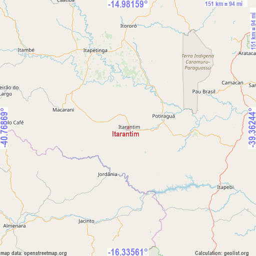
| Upper-left | -14.98159°, | -40.76869° |
| Center: | -15.65972°, | -40.06556° |
| Lower-right: | -16.33561°, | -39.36244° |
| Map W x H: | 150.6×150.6 km | = 93.6×93.6mi |
| max Lat: | 2.81972° ⇑45.6% North |
| Itarantim: | -15.65972° |
| min Lat: | ⇓54.4% South -33.69111° |
| min Long | Itarantim | max Long |
| -72.89583° | -40.06556° | -32.41083° |
| W 75.3%⇐ | ⇒24.7% E |
Elevation
Elevation of Itarantim is 255 m = 837 ft, and this is 125.9 m = 413 ft below average elevation for this country.
| Max E: |
1603 m = 5259 ft | 55.9% |
| Avg. | 380.9 m = 1250 ft | |
| Itarantim | 255 m = 837 ft | |
Min E: |
0 m = 0 ft | 44.1% |
See also: Brazil elevation on elevation.city.
Geographical zone
Itarantim is located in South Torrid zone (between Equator and Tropic of Capricorn). Distance of this Southern Tropic circle is 864.7 km =537.3 mi to South.| Distance of | km | miles | from Itarantim |
|---|---|---|---|
| Equator | 1741.2 | 1081.9 | to North |
| Tropic Capricorn | 864.7 | 537.3 | to South |
| Antarctic Circle | 5660 | 3517 | to South |
| South Pole | 8265.9 | 5136.2 | to South |


Nearby cities:
15 places around Itarantim: (largest is in red/bold)
• Almenara
89 km =55.3 mi,  229°
229°
• Buerarema
113.2 km =70.3 mi,  46°
46°
• Canavieiras
119.7 km =74.4 mi,  90°
90°
• Encruzilhada
91.5 km =56.9 mi,  278°
278°
• Eunápolis
95.2 km =59.2 mi,  146°
146°
• Guaratinga
107.3 km =66.7 mi,  163°
163°
• Ibicaraí
102.2 km =63.5 mi,  30°
30°
• Ibicuí
91.4 km =56.8 mi,  5°
5°
• Iguaí
100.5 km =62.4 mi,  358°
358°
• Itambé
75.6 km =47 mi,  307°
307°
• Itapetinga
49.7 km =30.9 mi,  336°
336°
• Itororó
60.4 km =37.5 mi, 359°
• Mascote
82.4 km =51.2 mi,  82°
82°
• Pau Brasil
49.4 km =30.7 mi,  63°
63°
• Una
113.7 km =70.6 mi,  68°
68°
Sources, notices
• [Note1] Compared only with cities in Brazil existing in our database
• [Src1] Map data: © OpenStreetMap contributors (CC-BY-SA)
• [Src2] Other city data from geonames.org with taken over terms of usage.
• [Src3] Geographical zone / Annual Mean Temperature by Robert A. Rohde @ Wikipedia
