General Salgado geodata
General Salgado (São Paulo) is a populated place; located in Brazil in America/Sao_Paulo (GMT-3) time zone. With population of 8,083 people, there are 1770 cities with bigger population in this country. Compared to other cities in Brazil, 60.8% of cities are located further ↑North; 79.7% of cities are located further →East and 63.5% of cities have lower elevation than General Salgado. Note1


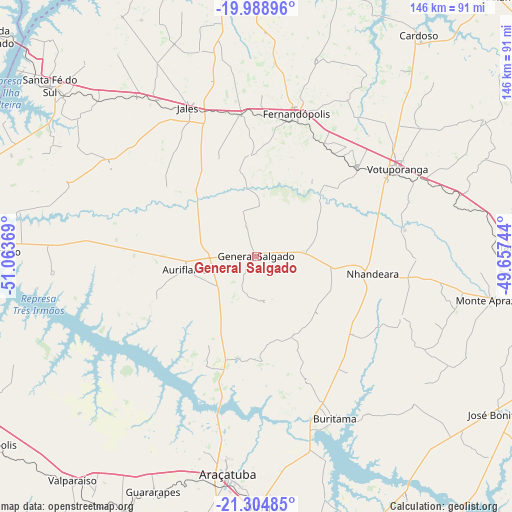
General Salgado GPS coordinates[2]
20° 38' 53.988" South, 50° 21' 38.016" West
| Map corner | latitude | longitude |
|---|---|---|
| Upper-left | -19.98896°, | -51.06369° |
| Center: | -20.64833°, | -50.36056° |
| Lower-right: | -21.30485°, | -49.65744° |
| Map W x H: | 146.3×146.3 km | = 90.9×90.9mi |
| max Lat: | 2.81972° ⇑60.8% North |
| General Salgado: | -20.64833° |
| min Lat: | ⇓39.2% South -33.69111° |
| min Long | General Salgado | max Long |
| -72.89583° | -50.36056° | -32.41083° |
| W 20.3%⇐ | ⇒79.7% E |
Elevation
Elevation of General Salgado is 512 m = 1680 ft, and this is 131.1 m = 430 ft above average elevation for this country.
| Max E: |
1603 m = 5259 ft | 36.5% |
| General Salgado | 512 m 1680 ft | |
| Avg. | 380.9 m = 1250 ft | |
Min E: |
0 m = 0 ft | 63.5% |
See also: Brazil elevation on elevation.city.
Geographical zone
General Salgado is located in South Torrid zone (between Equator and Tropic of Capricorn). Distance of this Southern Tropic circle is 310 km =192.6 mi to South.| Distance of | km | miles | from General Salgado |
|---|---|---|---|
| Equator | 2295.9 | 1426.6 | to North |
| Tropic Capricorn | 310 | 192.6 | to South |
| Antarctic Circle | 5105.3 | 3172.3 | to South |
| South Pole | 7711.2 | 4791.5 | to South |


Nearby cities:
15 places around General Salgado: (largest is in red/bold)
• Araçatuba
62.8 km =39 mi,  186°
186°
• Auriflama
20.6 km =12.8 mi,  258°
258°
• Birigui
71.2 km =44.2 mi,  178°
178°
• Buritama
51.5 km =32 mi,  154°
154°
• Cardoso
78.3 km =48.7 mi,  36°
36°
• Fernandópolis
42.2 km =26.2 mi,  16°
16°
• Guararapes
74.1 km =46 mi,  203°
203°
• Jales
46.4 km =28.8 mi,  335°
335°
• José Bonifácio
83.1 km =51.6 mi,  122°
122°
• Monte Aprazível
68.6 km =42.6 mi,  101°
101°
• Nhandeara
33.6 km =20.9 mi, 97°
• Pereira Barreto
77.9 km =48.4 mi,  270°
270°
• Santa Fé do Sul
76.4 km =47.5 mi,  309°
309°
• Tanabi
74.1 km =46 mi,  88°
88°
• Votuporanga
47.5 km =29.5 mi,  58°
58°
Sources, notices
• [Note1] Compared only with cities in Brazil existing in our database
• [Src1] Map data: © OpenStreetMap contributors (CC-BY-SA)
• [Src2] Other city data from geonames.org with taken over terms of usage.
• [Src3] Geographical zone / Annual Mean Temperature by Robert A. Rohde @ Wikipedia
