Jales geodata
Jales (São Paulo) is a populated place; located in Brazil in America/Sao_Paulo (GMT-3) time zone. With population of 43,831 people, there are 487 cities with bigger population in this country. Compared to other cities in Brazil, 58.6% of cities are located further ↑North; 80.5% of cities are located further →East and 62.8% of cities have lower elevation than Jales. Note1


Jales GPS coordinates[2]
20° 16' 8.004" South, 50° 32' 44.988" West
| Map corner | latitude | longitude |
|---|---|---|
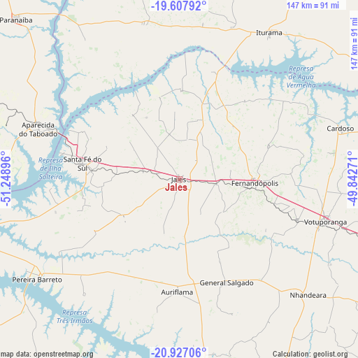
| Upper-left | -19.60792°, | -51.24896° |
| Center: | -20.26889°, | -50.54583° |
| Lower-right: | -20.92706°, | -49.84271° |
| Map W x H: | 146.7×146.7 km | = 91.2×91.2mi |
| max Lat: | 2.81972° ⇑58.6% North |
| Jales: | -20.26889° |
| min Lat: | ⇓41.4% South -33.69111° |
| min Long | Jales | max Long |
| -72.89583° | -50.54583° | -32.41083° |
| W 19.5%⇐ | ⇒80.5% E |
Elevation
Elevation of Jales is 507 m = 1663 ft, and this is 126.1 m = 414 ft above average elevation for this country.
| Max E: |
1603 m = 5259 ft | 37.2% |
| Jales | 507 m 1663 ft | |
| Avg. | 380.9 m = 1250 ft | |
Min E: |
0 m = 0 ft | 62.8% |
See also: Jales elevation on elevation.city.
Geographical zone
Jales is located in South Torrid zone (between Equator and Tropic of Capricorn). Distance of this Southern Tropic circle is 352.2 km =218.8 mi to South.| Distance of | km | miles | from Jales |
|---|---|---|---|
| Equator | 2253.7 | 1400.4 | to North |
| Tropic Capricorn | 352.2 | 218.8 | to South |
| Antarctic Circle | 5147.5 | 3198.5 | to South |
| South Pole | 7753.4 | 4817.7 | to South |


Nearby cities:
15 places around Jales: (largest is in red/bold)
• Aparecida do Taboado
60.7 km =37.7 mi,  289°
289°
• Auriflama
46.3 km =28.8 mi,  181°
181°
• Buritama
97.9 km =60.8 mi,  154°
154°
• Cardoso
69.1 km =42.9 mi,  72°
72°
• Fernandópolis
31.3 km =19.4 mi,  93°
93°
• General Salgado
46.4 km =28.8 mi,  155°
155°
• Ilha Solteira
85 km =52.8 mi,  257°
257°
• Iturama
70.4 km =43.7 mi,  31°
31°
• Nhandeara
70.4 km =43.7 mi,  131°
131°
• Paranaíba
94.2 km =58.5 mi,  314°
314°
• Pereira Barreto
71.6 km =44.5 mi,  235°
235°
• Riolândia
95.7 km =59.5 mi, 70°
• Santa Fé do Sul
40.2 km =25 mi,  279°
279°
• Tanabi
101.5 km =63.1 mi,  113°
113°
• Votuporanga
62.1 km =38.6 mi, 105°
Sources, notices
• [Note1] Compared only with cities in Brazil existing in our database
• [Src1] Map data: © OpenStreetMap contributors (CC-BY-SA)
• [Src2] Other city data from geonames.org with taken over terms of usage.
• [Src3] Geographical zone / Annual Mean Temperature by Robert A. Rohde @ Wikipedia
