Guiratinga geodata
Guiratinga (Mato Grosso) is a populated place; located in Brazil in America/Cuiaba (GMT-4) time zone. With population of 10,934 people, there are 1572 cities with bigger population in this country. Compared to other cities in Brazil, 52.6% of cities are located further ↓South; 92.1% of cities are located further →East and 62.9% of cities have lower elevation than Guiratinga. Note1


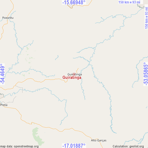
Guiratinga GPS coordinates[2]
16° 20' 43.224" South, 53° 45' 42.372" West
| Map corner | latitude | longitude |
|---|---|---|
| Upper-left | -15.66948°, | -54.4649° |
| Center: | -16.34534°, | -53.76177° |
| Lower-right: | -17.01887°, | -53.05865° |
| Map W x H: | 150×150 km | = 93.2×93.2mi |
| max Lat: | 2.81972° ⇑47.4% North |
| Guiratinga: | -16.34534° |
| min Lat: | ⇓52.6% South -33.69111° |
| min Long | Guiratinga | max Long |
| -72.89583° | -53.76177° | -32.41083° |
| W 7.9%⇐ | ⇒92.1% E |
Elevation
Elevation of Guiratinga is 508 m = 1667 ft, and this is 127.1 m = 417 ft above average elevation for this country.
| Max E: |
1603 m = 5259 ft | 37.1% |
| Guiratinga | 508 m 1667 ft | |
| Avg. | 380.9 m = 1250 ft | |
Min E: |
0 m = 0 ft | 62.9% |
See also: Brazil elevation on elevation.city.
Geographical zone
Guiratinga is located in South Torrid zone (between Equator and Tropic of Capricorn). Distance of this Southern Tropic circle is 788.5 km =490 mi to South.| Distance of | km | miles | from Guiratinga |
|---|---|---|---|
| Equator | 1817.4 | 1129.3 | to North |
| Tropic Capricorn | 788.5 | 490 | to South |
| Antarctic Circle | 5583.7 | 3469.5 | to South |
| South Pole | 8189.6 | 5088.8 | to South |


Nearby cities:
15 places around Guiratinga: (largest is in red/bold)
• Alto Araguaia
122.5 km =76.1 mi,  151°
151°
• Aragarças
168.9 km =104.9 mi,  72°
72°
• Araguaiana
217.2 km =135 mi, 71°
• Barra do Garças
168.6 km =104.8 mi, 72°
• Barão de Melgaço
236 km =146.6 mi,  274°
274°
• Caiapônia
218.7 km =135.9 mi,  108°
108°
• Chapada dos Guimarães
234.2 km =145.5 mi,  294°
294°
• Jaciara
135.6 km =84.3 mi, 288°
• Lucas
231.7 km =144 mi, 270°
• Mineiros
187.4 km =116.4 mi,  136°
136°
• Nova Xavantina
240 km =149.1 mi,  38°
38°
• Piranhas
207.1 km =128.7 mi,  92°
92°
• Portelândia
160.8 km =99.9 mi,  134°
134°
• Poxoréo
87.7 km =54.5 mi,  310°
310°
• Rondonópolis
94.2 km =58.5 mi,  261°
261°
Sources, notices
• [Note1] Compared only with cities in Brazil existing in our database
• [Src1] Map data: © OpenStreetMap contributors (CC-BY-SA)
• [Src2] Other city data from geonames.org with taken over terms of usage.
• [Src3] Geographical zone / Annual Mean Temperature by Robert A. Rohde @ Wikipedia
