Khudumelapye geodata
Khudumelapye (Kweneng) is a populated place; located in Botswana in Africa/Gaborone (GMT+2) time zone. With population of 2,035 people, there are 55 cities with bigger population in this country. Compared to other cities in Botswana, 60% of cities are located further ↑North; 74.3% of cities are located further →East and 75.2% of cities have lower elevation than Khudumelapye. Note1


Khudumelapye GPS coordinates[2]
23° 52' 59.988" South, 24° 45' 0" East
| Map corner | latitude | longitude |
|---|---|---|
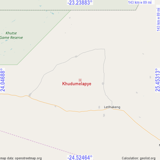
| Upper-left | -23.23883°, | 24.04688° |
| Center: | -23.88333°, | 24.75° |
| Lower-right: | -24.52464°, | 25.45313° |
| Map W x H: | 143×143 km | = 88.9×88.9mi |
| max Lat: | -17.80165° ⇑60% North |
| Khudumelapye: | -23.88333° |
| min Lat: | ⇓40% South -26.9° |
| min Long | Khudumelapye | max Long |
| 20.06667° | 24.75° | 28.74946° |
| W 25.7%⇐ | ⇒74.3% E |
Elevation
Elevation of Khudumelapye is 1100 m = 3609 ft, and this is 85 m = 279 ft above average elevation for this country.
| Max E: |
1406 m = 4613 ft | 24.8% |
| Khudumelapye | 1100 m 3609 ft | |
| Avg. | 1015 m = 3330 ft | |
Min E: |
676 m = 2218 ft | 75.2% |
See also: Botswana elevation on elevation.city.
Geographical zone
Khudumelapye is located in South temperate zone (between Tropic of Capricorn and the Antarctic Circle). Distance of this Southern Tropic circle is 49.7 km =30.9 mi to North.| Distance of | km | miles | from Khudumelapye |
|---|---|---|---|
| Equator | 2655.6 | 1650.1 | to North |
| Tropic Capricorn | 49.7 | 30.9 | to North |
| Antarctic Circle | 4745.6 | 2948.8 | to South |
| South Pole | 7351.5 | 4568 | to South |


Nearby cities:
15 places around Khudumelapye: (largest is in red/bold)
• Boatlaname
114.7 km =71.3 mi,  74°
74°
• Botlhapatlou
76.8 km =47.7 mi,  101°
101°
• Dutlwe
87.1 km =54.1 mi,  262°
262°
• Galekgatshwane
128.5 km =79.8 mi,  123°
123°
• Gaphatshwe
134.1 km =83.3 mi, 124°
• Jwaneng
79.9 km =49.6 mi,  181°
181°
• Kopong
132.9 km =82.6 mi, 120°
• Lenchwe Le Tau
124.7 km =77.5 mi, 116°
• Letlhakeng
36.9 km =22.9 mi,  129°
129°
• Metsemotlhaba
130.1 km =80.8 mi, 124°
• Molepolole
95.4 km =59.3 mi, 127°
• Mononyane
126.8 km =78.8 mi, 125°
• Mosopa
120 km =74.6 mi,  145°
145°
• Sekoma
105 km =65.2 mi,  236°
236°
• Thamaga
118.6 km =73.7 mi,  137°
137°
Sources, notices
• [Note1] Compared only with cities in Botswana existing in our database
• [Src1] Map data: © OpenStreetMap contributors (CC-BY-SA)
• [Src2] Other city data from geonames.org with taken over terms of usage.
• [Src3] Geographical zone / Annual Mean Temperature by Robert A. Rohde @ Wikipedia
