Carberry geodata
Carberry (Manitoba) is a populated place; located in Canada in America/Winnipeg (GMT-5) time zone. With population of 1,575 people, there are 841 cities with bigger population in this country. Compared to other cities in Canada, 74.5% of cities are located further ↓South; 67.9% of cities are located further →East and 77.4% of cities have lower elevation than Carberry. Note1


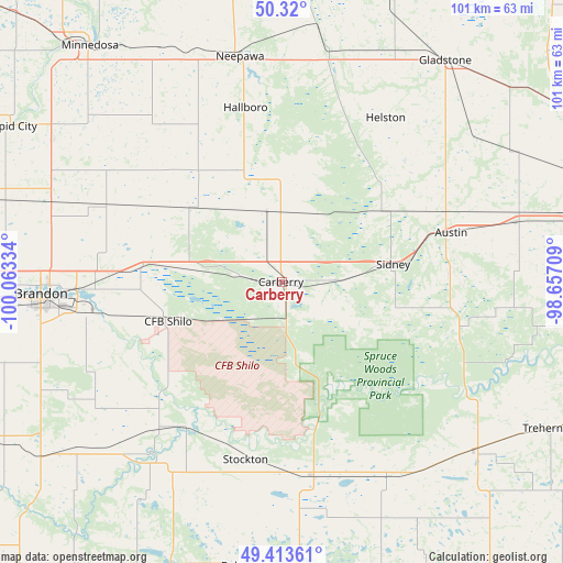
Carberry GPS coordinates[2]
49° 52' 8.148" North, 99° 21' 36.756" West
| Map corner | latitude | longitude |
|---|---|---|
| Upper-left | 50.32°, | -100.06334° |
| Center: | 49.86893°, | -99.36021° |
| Lower-right: | 49.41361°, | -98.65709° |
| Map W x H: | 100.8×100.8 km | = 62.6×62.6mi |
| max Lat: | 73.03752° ⇑25.5% North |
| Carberry: | 49.86893° |
| min Lat: | ⇓74.5% South 42.05009° |
| min Long | Carberry | max Long |
| -139.43328° | -99.36021° | -52.70931° |
| W 32.1%⇐ | ⇒67.9% E |
Elevation
Elevation of Carberry is 385 m = 1263 ft, and this is 130.6 m = 428 ft above average elevation for this country.
| Max E: |
1518 m = 4980 ft | 22.6% |
| Carberry | 385 m 1263 ft | |
| Avg. | 254.4 m = 835 ft | |
Min E: |
-2 m = -7 ft | 77.4% |
See also: Canada elevation on elevation.city.
Geographical zone
Carberry is located in North temperate zone (between Tropic of Cancer and the Arctic Circle). Distance of this North polar circle is 1856.3 km =1153.5 mi to North.| Distance of | km | miles | from Carberry |
|---|---|---|---|
| North Pole | 4462.2 | 2772.7 | to North |
| Arctic Circle | 1856.3 | 1153.5 | to North |
| Tropic Cancer | 2939 | 1826.2 | to South |
| Equator | 5544.9 | 3445.4 | to South |


Nearby cities:
15 places around Carberry: (largest is in red/bold)
• Boissevain
86.9 km =54 mi,  215°
215°
• Brandon
42.6 km =26.5 mi,  266°
266°
• Carman
106 km =65.9 mi,  112°
112°
• Deloraine
111.3 km =69.2 mi,  227°
227°
• Killarney
79.3 km =49.3 mi,  196°
196°
• Minnedosa
54.2 km =33.7 mi,  320°
320°
• Morden
118 km =73.3 mi,  129°
129°
• Neepawa
40.7 km =25.3 mi,  349°
349°
• Portage la Prairie
77.3 km =48 mi,  81°
81°
• Rivers
65.5 km =40.7 mi,  285°
285°
• Shilo
20.7 km =12.9 mi,  249°
249°
• Souris
70.5 km =43.8 mi, 246°
• St. Claude
76.7 km =47.7 mi, 107°
• Virden
112.7 km =70 mi, 268°
• Winkler
127.8 km =79.4 mi, 126°
Sources, notices
• [Note1] Compared only with cities in Canada existing in our database
• [Src1] Map data: © OpenStreetMap contributors (CC-BY-SA)
• [Src2] Other city data from geonames.org with taken over terms of usage.
• [Src3] Geographical zone / Annual Mean Temperature by Robert A. Rohde @ Wikipedia
