Virden geodata
Virden (Manitoba) is a populated place; located in Canada in America/Winnipeg (GMT-5) time zone. With population of 3,237 people, there are 588 cities with bigger population in this country. Compared to other cities in Canada, 74.2% of cities are located further ↓South; 68.9% of cities are located further →East and 79.8% of cities have lower elevation than Virden. Note1


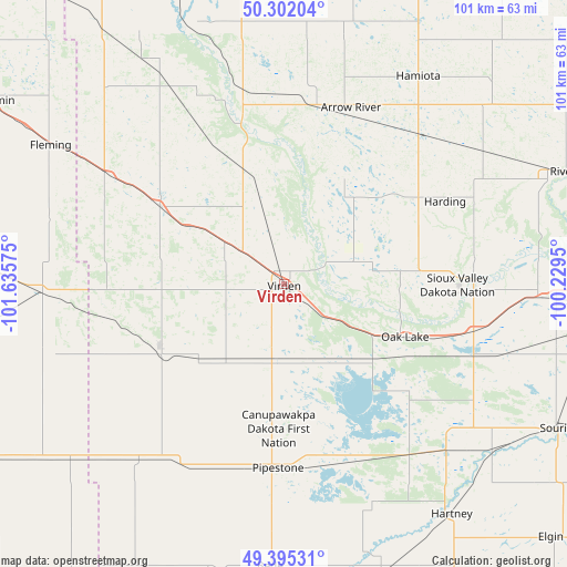
Virden GPS coordinates[2]
49° 51' 2.88" North, 100° 55' 57.432" West
| Map corner | latitude | longitude |
|---|---|---|
| Upper-left | 50.30204°, | -101.63575° |
| Center: | 49.8508°, | -100.93262° |
| Lower-right: | 49.39531°, | -100.2295° |
| Map W x H: | 100.8×100.8 km | = 62.6×62.6mi |
| max Lat: | 73.03752° ⇑25.8% North |
| Virden: | 49.8508° |
| min Lat: | ⇓74.2% South 42.05009° |
| min Long | Virden | max Long |
| -139.43328° | -100.93262° | -52.70931° |
| W 31.1%⇐ | ⇒68.9% E |
Elevation
Elevation of Virden is 442 m = 1450 ft, and this is 187.6 m = 615 ft above average elevation for this country.
| Max E: |
1518 m = 4980 ft | 20.2% |
| Virden | 442 m 1450 ft | |
| Avg. | 254.4 m = 835 ft | |
Min E: |
-2 m = -7 ft | 79.8% |
See also: Canada elevation on elevation.city.
Geographical zone
Virden is located in North temperate zone (between Tropic of Cancer and the Arctic Circle). Distance of this North polar circle is 1858.3 km =1154.7 mi to North.| Distance of | km | miles | from Virden |
|---|---|---|---|
| North Pole | 4464.2 | 2773.9 | to North |
| Arctic Circle | 1858.3 | 1154.7 | to North |
| Tropic Cancer | 2937 | 1825 | to South |
| Equator | 5542.9 | 3444.2 | to South |


Nearby cities:
15 places around Virden: (largest is in red/bold)
• Boissevain
93.6 km =58.2 mi,  137°
137°
• Brandon
70.2 km =43.6 mi,  90°
90°
• Carberry
112.7 km =70 mi, 88°
• Carlyle
98.9 km =61.5 mi,  255°
255°
• Carnduff
98.6 km =61.3 mi,  219°
219°
• Deloraine
79.9 km =49.6 mi,  156°
156°
• Killarney
117.9 km =73.3 mi,  129°
129°
• Melita
65 km =40.4 mi,  184°
184°
• Minnedosa
89.3 km =55.5 mi,  60°
60°
• Moosomin
61.2 km =38 mi,  300°
300°
• Neepawa
112.8 km =70.1 mi,  68°
68°
• Oxbow
112.5 km =69.9 mi,  232°
232°
• Rivers
53.4 km =33.2 mi, 68°
• Shilo
93.4 km =58 mi, 93°
• Souris
54.8 km =34.1 mi,  118°
118°
Sources, notices
• [Note1] Compared only with cities in Canada existing in our database
• [Src1] Map data: © OpenStreetMap contributors (CC-BY-SA)
• [Src2] Other city data from geonames.org with taken over terms of usage.
• [Src3] Geographical zone / Annual Mean Temperature by Robert A. Rohde @ Wikipedia
