Hanceville geodata
Hanceville (British Columbia) is a populated locality; located in Canada in America/Vancouver (GMT-7) time zone. With population of 10,000 people, there are 310 cities with bigger population in this country. Compared to other cities in Canada, 85.7% of cities are located further ↓South; 93.1% of cities are located further →East and 91.3% of cities have lower elevation than Hanceville. Note1


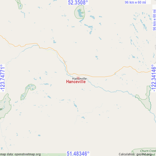
Hanceville GPS coordinates[2]
51° 55' 9.192" North, 123° 2' 40.488" West
| Map corner | latitude | longitude |
|---|---|---|
| Upper-left | 52.3508°, | -123.74771° |
| Center: | 51.91922°, | -123.04458° |
| Lower-right: | 51.48346°, | -122.34146° |
| Map W x H: | 96.4×96.4 km | = 59.9×59.9mi |
| max Lat: | 73.03752° ⇑14.3% North |
| Hanceville: | 51.91922° |
| min Lat: | ⇓85.7% South 42.05009° |
| min Long | Hanceville | max Long |
| -139.43328° | -123.04458° | -52.70931° |
| W 6.9%⇐ | ⇒93.1% E |
Elevation
Elevation of Hanceville is 691 m = 2267 ft, and this is 436.6 m = 1432 ft above average elevation for this country.
| Max E: |
1518 m = 4980 ft | 8.7% |
| Hanceville | 691 m 2267 ft | |
| Avg. | 254.4 m = 835 ft | |
Min E: |
-2 m = -7 ft | 91.3% |
See also: Canada elevation on elevation.city.
Geographical zone
Hanceville is located in North temperate zone (between Tropic of Cancer and the Arctic Circle). Distance of this North polar circle is 1628.3 km =1011.8 mi to North.| Distance of | km | miles | from Hanceville |
|---|---|---|---|
| North Pole | 4234.2 | 2631 | to North |
| Arctic Circle | 1628.3 | 1011.8 | to North |
| Tropic Cancer | 3167 | 1967.9 | to South |
| Equator | 5772.9 | 3587.1 | to South |


Nearby cities:
15 places around Hanceville: (largest is in red/bold)
• Ashcroft
180.7 km =112.3 mi,  137°
137°
• Barrière
218.2 km =135.6 mi,  112°
112°
• Cache Creek
171.6 km =106.6 mi, 135°
• Clinton
137.2 km =85.3 mi,  132°
132°
• Fox Mountain
68.5 km =42.6 mi,  68°
68°
• Kamloops
235.2 km =146.1 mi, 126°
• Lillooet
157.1 km =97.6 mi,  150°
150°
• Logan Lake
222 km =137.9 mi, 135°
• Mount Currie 6
178.8 km =111.1 mi,  171°
171°
• Pemberton
179 km =111.2 mi, 174°
• Prince George
222.9 km =138.5 mi,  5°
5°
• Quesnel
123.6 km =76.8 mi,  17°
17°
• Vanderhoof
242.2 km =150.5 mi,  344°
344°
• Whistler
200.4 km =124.5 mi,  178°
178°
• Williams Lake
66.3 km =41.2 mi, 68°
Sources, notices
• [Note1] Compared only with cities in Canada existing in our database
• [Src1] Map data: © OpenStreetMap contributors (CC-BY-SA)
• [Src2] Other city data from geonames.org with taken over terms of usage.
• [Src3] Geographical zone / Annual Mean Temperature by Robert A. Rohde @ Wikipedia
