Quesnel geodata
Quesnel (British Columbia) is a populated place; located in Canada in America/Vancouver (GMT-7) time zone. With population of 13,788 people, there are 256 cities with bigger population in this country. Compared to other cities in Canada, 89.3% of cities are located further ↓South; 91.5% of cities are located further →East and 80.8% of cities have lower elevation than Quesnel. Note1
Administrative division(s):
- Level 1: British Columbia
- Level 2: Cariboo Regional District
- Level 3: Quesnel


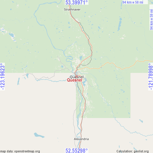
Quesnel GPS coordinates[2]
52° 58' 42.312" North, 122° 29' 35.16" West
| Map corner | latitude | longitude |
|---|---|---|
| Upper-left | 53.39971°, | -123.19623° |
| Center: | 52.97842°, | -122.4931° |
| Lower-right: | 52.55298°, | -121.78998° |
| Map W x H: | 94.1×94.1 km | = 58.5×58.5mi |
| max Lat: | 73.03752° ⇑10.7% North |
| Quesnel: | 52.97842° |
| min Lat: | ⇓89.3% South 42.05009° |
| min Long | Quesnel | max Long |
| -139.43328° | -122.4931° | -52.70931° |
| W 8.5%⇐ | ⇒91.5% E |
Elevation
Elevation of Quesnel is 479 m = 1572 ft, and this is 224.6 m = 737 ft above average elevation for this country.
| Max E: |
1518 m = 4980 ft | 19.2% |
| Quesnel | 479 m 1572 ft | |
| Avg. | 254.4 m = 835 ft | |
Min E: |
-2 m = -7 ft | 80.8% |
See also: Canada elevation on elevation.city.
Geographical zone
Quesnel is located in North temperate zone (between Tropic of Cancer and the Arctic Circle). Distance of this North polar circle is 1510.5 km =938.6 mi to North.| Distance of | km | miles | from Quesnel |
|---|---|---|---|
| North Pole | 4116.4 | 2557.8 | to North |
| Arctic Circle | 1510.5 | 938.6 | to North |
| Tropic Cancer | 3284.7 | 2041 | to South |
| Equator | 5890.6 | 3660.2 | to South |


Nearby cities:
15 places around Quesnel: (largest is in red/bold)
• Ashcroft
264.1 km =164.1 mi,  161°
161°
• Barrière
257.2 km =159.8 mi,  140°
140°
• Burns Lake
256.5 km =159.4 mi,  302°
302°
• Cache Creek
254.1 km =157.9 mi, 161°
• Clinton
219.7 km =136.5 mi, 163°
• Fox Mountain
96.2 km =59.8 mi, 164°
• Grande Cache
244.1 km =151.7 mi,  65°
65°
• Hanceville
123.6 km =76.8 mi,  197°
197°
• Lillooet
257.7 km =160.1 mi,  171°
171°
• Mackenzie
265.1 km =164.7 mi,  351°
351°
• Mount Currie 6
294.8 km =183.2 mi,  182°
182°
• Prince George
105.7 km =65.7 mi, 350°
• Tumbler Ridge
258.5 km =160.6 mi,  22°
22°
• Vanderhoof
153.4 km =95.3 mi,  318°
318°
• Williams Lake
96 km =59.7 mi, 165°
Sources, notices
• [Note1] Compared only with cities in Canada existing in our database
• [Src1] Map data: © OpenStreetMap contributors (CC-BY-SA)
• [Src2] Other city data from geonames.org with taken over terms of usage.
• [Src3] Geographical zone / Annual Mean Temperature by Robert A. Rohde @ Wikipedia
