Prince George geodata
Prince George (British Columbia) is a populated place; located in Canada in America/Vancouver (GMT-7) time zone. With population of 65,558 people, there are 86 cities with bigger population in this country. Compared to other cities in Canada, 93% of cities are located further ↓South; 92.1% of cities are located further →East and 85.4% of cities have lower elevation than Prince George. Note1
Administrative division(s):
- Level 1: British Columbia
- Level 2: Regional District of Fraser-Fort George
- Level 3: Prince George


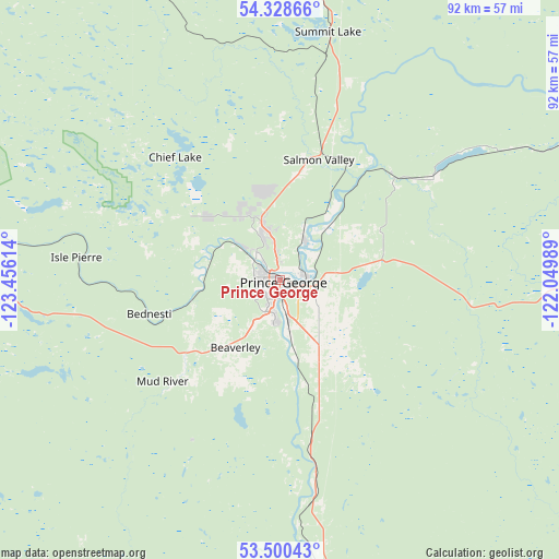
Prince George GPS coordinates[2]
53° 54' 59.76" North, 122° 45' 10.836" West
| Map corner | latitude | longitude |
|---|---|---|
| Upper-left | 54.32866°, | -123.45614° |
| Center: | 53.9166°, | -122.75301° |
| Lower-right: | 53.50043°, | -122.04989° |
| Map W x H: | 92.1×92.1 km | = 57.2×57.2mi |
| max Lat: | 73.03752° ⇑7% North |
| Prince George: | 53.9166° |
| min Lat: | ⇓93% South 42.05009° |
| min Long | Prince George | max Long |
| -139.43328° | -122.75301° | -52.70931° |
| W 7.9%⇐ | ⇒92.1% E |
Elevation
Elevation of Prince George is 578 m = 1896 ft, and this is 323.6 m = 1062 ft above average elevation for this country.
| Max E: |
1518 m = 4980 ft | 14.6% |
| Prince George | 578 m 1896 ft | |
| Avg. | 254.4 m = 835 ft | |
Min E: |
-2 m = -7 ft | 85.4% |
See also: Prince George elevation on elevation.city.
Geographical zone
Prince George is located in North temperate zone (between Tropic of Cancer and the Arctic Circle). Distance of this North polar circle is 1406.2 km =873.8 mi to North.| Distance of | km | miles | from Prince George |
|---|---|---|---|
| North Pole | 4012.1 | 2493 | to North |
| Arctic Circle | 1406.2 | 873.8 | to North |
| Tropic Cancer | 3389 | 2105.8 | to South |
| Equator | 5995 | 3725.1 | to South |


Nearby cities:
15 places around Prince George: (largest is in red/bold)
• Beaverlodge
258.1 km =160.4 mi,  55°
55°
• Burns Lake
199.3 km =123.8 mi,  280°
280°
• Chetwynd
210.8 km =131 mi,  19°
19°
• Dawson Creek
260.5 km =161.9 mi,  38°
38°
• Fox Mountain
201.7 km =125.3 mi,  167°
167°
• Grand Haven
283.3 km =176 mi, 24°
• Grande Cache
237 km =147.3 mi,  90°
90°
• Hanceville
222.9 km =138.5 mi,  185°
185°
• Houston
260.6 km =161.9 mi, 281°
• Mackenzie
159.4 km =99 mi,  352°
352°
• Quesnel
105.7 km =65.7 mi, 170°
• Tumbler Ridge
176.3 km =109.5 mi, 40°
• Vanderhoof
83.6 km =51.9 mi, 277°
• Wembley
270.6 km =168.1 mi, 59°
• Williams Lake
201.5 km =125.2 mi, 168°
Sources, notices
• [Note1] Compared only with cities in Canada existing in our database
• [Src1] Map data: © OpenStreetMap contributors (CC-BY-SA)
• [Src2] Other city data from geonames.org with taken over terms of usage.
• [Src3] Geographical zone / Annual Mean Temperature by Robert A. Rohde @ Wikipedia
