High Level geodata
High Level (Alberta) is a populated place; located in Canada in America/Edmonton (GMT-6) time zone. With population of 3,621 people, there are 561 cities with bigger population in this country. Compared to other cities in Canada, 97.6% of cities are located further ↓South; 84.8% of cities are located further →East and 72.1% of cities have lower elevation than High Level. Note1


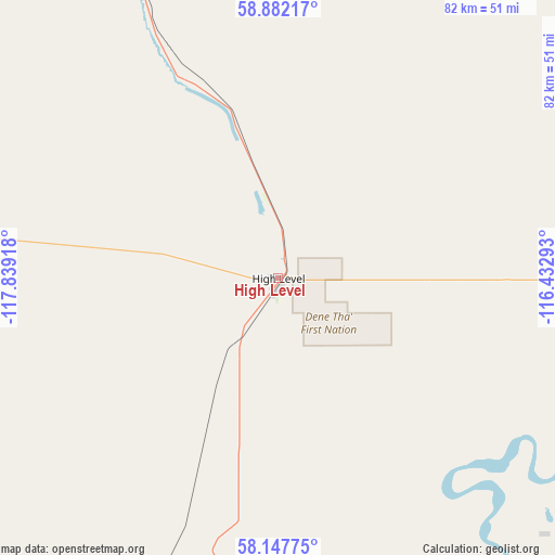
High Level GPS coordinates[2]
58° 31' 0.768" North, 117° 8' 9.78" West
| Map corner | latitude | longitude |
|---|---|---|
| Upper-left | 58.88217°, | -117.83918° |
| Center: | 58.51688°, | -117.13605° |
| Lower-right: | 58.14775°, | -116.43293° |
| Map W x H: | 81.7×81.7 km | = 50.8×50.8mi |
| max Lat: | 73.03752° ⇑2.4% North |
| High Level: | 58.51688° |
| min Lat: | ⇓97.6% South 42.05009° |
| min Long | High Level | max Long |
| -139.43328° | -117.13605° | -52.70931° |
| W 15.2%⇐ | ⇒84.8% E |
Elevation
Elevation of High Level is 329 m = 1079 ft, and this is 74.6 m = 245 ft above average elevation for this country.
| Max E: |
1518 m = 4980 ft | 27.9% |
| High Level | 329 m 1079 ft | |
| Avg. | 254.4 m = 835 ft | |
Min E: |
-2 m = -7 ft | 72.1% |
See also: Canada elevation on elevation.city.
Geographical zone
High Level is located in North temperate zone (between Tropic of Cancer and the Arctic Circle). Distance of this North polar circle is 894.7 km =555.9 mi to North.| Distance of | km | miles | from High Level |
|---|---|---|---|
| North Pole | 3500.6 | 2175.2 | to North |
| Arctic Circle | 894.7 | 555.9 | to North |
| Tropic Cancer | 3900.5 | 2423.7 | to South |
| Equator | 6506.5 | 4043 | to South |


Nearby cities:
15 places around High Level: (largest is in red/bold)
• Fairview
282.6 km =175.6 mi,  195°
195°
• Falher
309.5 km =192.3 mi,  180°
180°
• Grande Prairie
386 km =239.8 mi, 195°
• Grimshaw
261 km =162.2 mi,  186°
186°
• Hay River
266.4 km =165.5 mi,  16°
16°
• High Prairie
345.1 km =214.4 mi,  173°
173°
• Manning
180.2 km =112 mi, 189°
• Paddle Prairie
66.3 km =41.2 mi, 198°
• Peace River
253.7 km =157.6 mi, 182°
• Sexsmith
366 km =227.4 mi, 195°
• Spirit River
320.8 km =199.3 mi, 198°
• Valleyview
383.7 km =238.4 mi, 181°
• Wedgewood
390.3 km =242.5 mi, 194°
• Wembley
393.6 km =244.6 mi, 197°
• Westlake
380.1 km =236.2 mi, 195°
Sources, notices
• [Note1] Compared only with cities in Canada existing in our database
• [Src1] Map data: © OpenStreetMap contributors (CC-BY-SA)
• [Src2] Other city data from geonames.org with taken over terms of usage.
• [Src3] Geographical zone / Annual Mean Temperature by Robert A. Rohde @ Wikipedia
