Falher geodata
Falher (Alberta) is a populated place; located in Canada in America/Edmonton (GMT-6) time zone. With population of 1,166 people, there are 967 cities with bigger population in this country. Compared to other cities in Canada, 96.5% of cities are located further ↓South; 84.8% of cities are located further →East and 85.4% of cities have lower elevation than Falher. Note1


Falher GPS coordinates[2]
55° 44' 0.204" North, 117° 12' 9.432" West
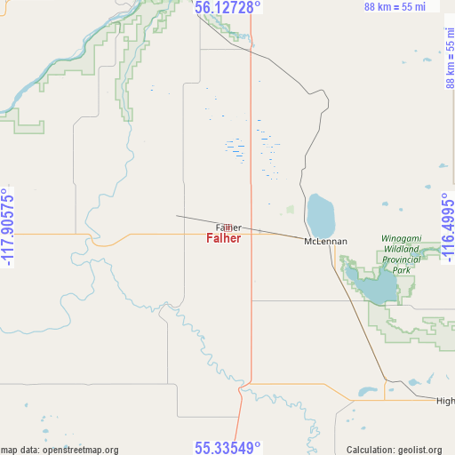
| Map corner | latitude | longitude |
|---|---|---|
| Upper-left | 56.12728°, | -117.90575° |
| Center: | 55.73339°, | -117.20262° |
| Lower-right: | 55.33549°, | -116.4995° |
| Map W x H: | 88×88 km | = 54.7×54.7mi |
| max Lat: | 73.03752° ⇑3.5% North |
| Falher: | 55.73339° |
| min Lat: | ⇓96.5% South 42.05009° |
| min Long | Falher | max Long |
| -139.43328° | -117.20262° | -52.70931° |
| W 15.2%⇐ | ⇒84.8% E |
Elevation
Elevation of Falher is 578 m = 1896 ft, and this is 323.6 m = 1062 ft above average elevation for this country.
| Max E: |
1518 m = 4980 ft | 14.6% |
| Falher | 578 m 1896 ft | |
| Avg. | 254.4 m = 835 ft | |
Min E: |
-2 m = -7 ft | 85.4% |
See also: Canada elevation on elevation.city.
Geographical zone
Falher is located in North temperate zone (between Tropic of Cancer and the Arctic Circle). Distance of this North polar circle is 1204.2 km =748.3 mi to North.| Distance of | km | miles | from Falher |
|---|---|---|---|
| North Pole | 3810.1 | 2367.5 | to North |
| Arctic Circle | 1204.2 | 748.3 | to North |
| Tropic Cancer | 3591.1 | 2231.4 | to South |
| Equator | 6197 | 3850.6 | to South |


Nearby cities:
15 places around Falher: (largest is in red/bold)
• Beaverlodge
152 km =94.4 mi,  247°
247°
• Fairview
82.6 km =51.3 mi,  296°
296°
• Fox Creek
150.4 km =93.5 mi,  170°
170°
• Grande Prairie
119 km =73.9 mi,  238°
238°
• Grimshaw
55.9 km =34.7 mi,  333°
333°
• High Prairie
56.1 km =34.9 mi,  126°
126°
• Manning
134.1 km =83.3 mi,  348°
348°
• Peace River
56.3 km =35 mi, 354°
• Sexsmith
108.4 km =67.4 mi, 246°
• Spirit River
102.3 km =63.6 mi,  273°
273°
• Swan Hills
160.7 km =99.9 mi, 134°
• Valleyview
74.3 km =46.2 mi,  184°
184°
• Wedgewood
120.1 km =74.6 mi, 235°
• Wembley
138.1 km =85.8 mi, 241°
• Westlake
115.8 km =72 mi, 240°
Sources, notices
• [Note1] Compared only with cities in Canada existing in our database
• [Src1] Map data: © OpenStreetMap contributors (CC-BY-SA)
• [Src2] Other city data from geonames.org with taken over terms of usage.
• [Src3] Geographical zone / Annual Mean Temperature by Robert A. Rohde @ Wikipedia
