Mackenzie geodata
Mackenzie (British Columbia) is a populated place; located in Canada in America/Vancouver (GMT-7) time zone. With population of 3,262 people, there are 585 cities with bigger population in this country. Compared to other cities in Canada, 96% of cities are located further ↓South; 93.4% of cities are located further →East and 94.2% of cities have lower elevation than Mackenzie. Note1
Administrative division(s):
- Level 1: British Columbia
- Level 2: Regional District of Fraser-Fort George
- Level 3: Mackenzie


Mackenzie GPS coordinates[2]
55° 20' 10.932" North, 123° 5' 37.464" West
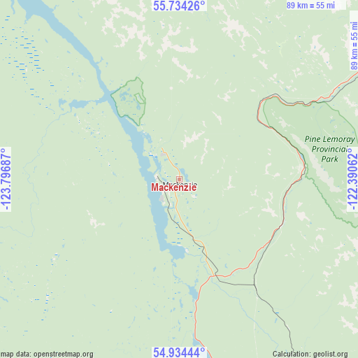
| Map corner | latitude | longitude |
|---|---|---|
| Upper-left | 55.73426°, | -123.79687° |
| Center: | 55.33637°, | -123.09374° |
| Lower-right: | 54.93444°, | -122.39062° |
| Map W x H: | 88.9×88.9 km | = 55.2×55.2mi |
| max Lat: | 73.03752° ⇑4% North |
| Mackenzie: | 55.33637° |
| min Lat: | ⇓96% South 42.05009° |
| min Long | Mackenzie | max Long |
| -139.43328° | -123.09374° | -52.70931° |
| W 6.6%⇐ | ⇒93.4% E |
Elevation
Elevation of Mackenzie is 771 m = 2530 ft, and this is 516.6 m = 1695 ft above average elevation for this country.
| Max E: |
1518 m = 4980 ft | 5.8% |
| Mackenzie | 771 m 2530 ft | |
| Avg. | 254.4 m = 835 ft | |
Min E: |
-2 m = -7 ft | 94.2% |
See also: Canada elevation on elevation.city.
Geographical zone
Mackenzie is located in North temperate zone (between Tropic of Cancer and the Arctic Circle). Distance of this North polar circle is 1248.3 km =775.7 mi to North.| Distance of | km | miles | from Mackenzie |
|---|---|---|---|
| North Pole | 3854.2 | 2394.9 | to North |
| Arctic Circle | 1248.3 | 775.7 | to North |
| Tropic Cancer | 3546.9 | 2203.9 | to South |
| Equator | 6152.8 | 3823.2 | to South |


Nearby cities:
15 places around Mackenzie: (largest is in red/bold)
• Beaverlodge
232 km =144.2 mi,  93°
93°
• Burns Lake
210.7 km =130.9 mi,  234°
234°
• Chetwynd
100.3 km =62.3 mi,  66°
66°
• Dawson Creek
185.5 km =115.3 mi,  75°
75°
• Fort St. John
173 km =107.5 mi,  54°
54°
• Fox Mountain
360.7 km =224.1 mi,  169°
169°
• Grand Haven
169.6 km =105.4 mi, 53°
• Hanceville
380 km =236.1 mi,  179°
179°
• Houston
251.4 km =156.2 mi,  245°
245°
• Prince George
159.4 km =99 mi, 172°
• Quesnel
265.1 km =164.7 mi, 171°
• Tumbler Ridge
135.1 km =83.9 mi,  99°
99°
• Vanderhoof
158.4 km =98.4 mi,  202°
202°
• Wembley
251.7 km =156.4 mi, 94°
• Williams Lake
360.7 km =224.1 mi, 170°
Sources, notices
• [Note1] Compared only with cities in Canada existing in our database
• [Src1] Map data: © OpenStreetMap contributors (CC-BY-SA)
• [Src2] Other city data from geonames.org with taken over terms of usage.
• [Src3] Geographical zone / Annual Mean Temperature by Robert A. Rohde @ Wikipedia
