Swan River geodata
Swan River (Manitoba) is a populated place; located in Canada in America/Winnipeg (GMT-5) time zone. With population of 4,198 people, there are 519 cities with bigger population in this country. Compared to other cities in Canada, 86.1% of cities are located further ↓South; 69.2% of cities are located further →East and 73.4% of cities have lower elevation than Swan River. Note1


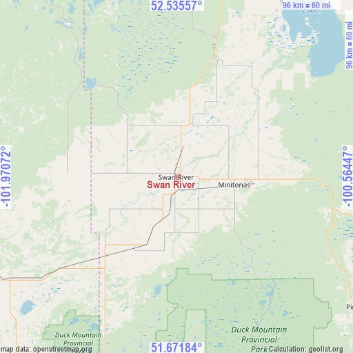
Swan River GPS coordinates[2]
52° 6' 20.88" North, 101° 16' 3.324" West
| Map corner | latitude | longitude |
|---|---|---|
| Upper-left | 52.53557°, | -101.97072° |
| Center: | 52.1058°, | -101.26759° |
| Lower-right: | 51.67184°, | -100.56447° |
| Map W x H: | 96×96 km | = 59.7×59.7mi |
| max Lat: | 73.03752° ⇑13.9% North |
| Swan River: | 52.1058° |
| min Lat: | ⇓86.1% South 42.05009° |
| min Long | Swan River | max Long |
| -139.43328° | -101.26759° | -52.70931° |
| W 30.8%⇐ | ⇒69.2% E |
Elevation
Elevation of Swan River is 340 m = 1115 ft, and this is 85.6 m = 281 ft above average elevation for this country.
| Max E: |
1518 m = 4980 ft | 26.6% |
| Swan River | 340 m 1115 ft | |
| Avg. | 254.4 m = 835 ft | |
Min E: |
-2 m = -7 ft | 73.4% |
See also: Canada elevation on elevation.city.
Geographical zone
Swan River is located in North temperate zone (between Tropic of Cancer and the Arctic Circle). Distance of this North polar circle is 1607.6 km =998.9 mi to North.| Distance of | km | miles | from Swan River |
|---|---|---|---|
| North Pole | 4213.4 | 2618.1 | to North |
| Arctic Circle | 1607.6 | 998.9 | to North |
| Tropic Cancer | 3187.7 | 1980.7 | to South |
| Equator | 5793.6 | 3600 | to South |


Nearby cities:
15 places around Swan River: (largest is in red/bold)
• Camperville
78 km =48.5 mi,  99°
99°
• Canora
95.8 km =59.5 mi,  236°
236°
• Dauphin
135.5 km =84.2 mi,  141°
141°
• Esterhazy
171.5 km =106.6 mi,  199°
199°
• Foam Lake
163.6 km =101.7 mi,  251°
251°
• Hudson Bay
112.1 km =69.7 mi,  317°
317°
• Kamsack
74.1 km =46 mi,  215°
215°
• Kelvington
154.8 km =96.2 mi,  272°
272°
• Langenburg
143.1 km =88.9 mi,  192°
192°
• Melville
169.5 km =105.3 mi, 218°
• Preeceville
97.3 km =60.5 mi,  259°
259°
• Roblin
97.6 km =60.6 mi,  183°
183°
• The Pas
191.2 km =118.8 mi,  0°
0°
• Wadena
174.2 km =108.2 mi, 264°
• Yorkton
128.9 km =80.1 mi, 219°
Sources, notices
• [Note1] Compared only with cities in Canada existing in our database
• [Src1] Map data: © OpenStreetMap contributors (CC-BY-SA)
• [Src2] Other city data from geonames.org with taken over terms of usage.
• [Src3] Geographical zone / Annual Mean Temperature by Robert A. Rohde @ Wikipedia
