Kasongo-Lunda geodata
Kasongo-Lunda (Kwango) is a populated place; located in Democratic Republic of the Congo in Africa/Kinshasa (GMT+1) time zone. With population of 20,060 people, there are 64 cities with bigger population in this country. Compared to other cities in Democratic Republic of the Congo, 87.1% of cities are located further ↑North; 87.1% of cities are located further →East and 54.3% of cities have lower elevation than Kasongo-Lunda. Note1


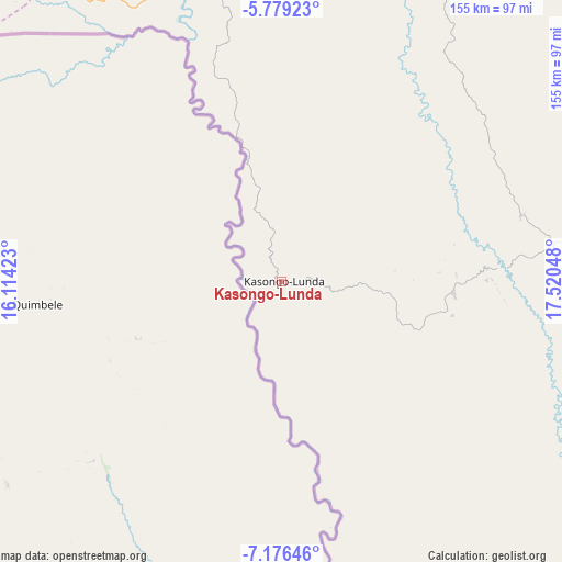
Kasongo-Lunda GPS coordinates[2]
6° 28' 41.988" South, 16° 49' 2.46" East
| Map corner | latitude | longitude |
|---|---|---|
| Upper-left | -5.77923°, | 16.11423° |
| Center: | -6.47833°, | 16.81735° |
| Lower-right: | -7.17646°, | 17.52048° |
| Map W x H: | 155.4×155.4 km | = 96.6×96.6mi |
| max Lat: | 4.279° ⇑87.1% North |
| Kasongo-Lunda: | -6.47833° |
| min Lat: | ⇓12.9% South -11.76097° |
| min Long | Kasongo-Lunda | max Long |
| 12.37148° | 16.81735° | 30.25224° |
| W 12.9%⇐ | ⇒87.1% E |
Elevation
Elevation of Kasongo-Lunda is 534 m = 1752 ft, and this is 122 m = 400 ft below average elevation for this country.
| Max E: |
1996 m = 6549 ft | 45.7% |
| Avg. | 656 m = 2152 ft | |
| Kasongo-Lunda | 534 m = 1752 ft | |
Min E: |
11 m = 36 ft | 54.3% |
See also: Democratic Republic of the Congo elevation on elevation.city.
Geographical zone
Kasongo-Lunda is located in South Torrid zone (between Equator and Tropic of Capricorn). Distance of Equator is 720.3 km =447.6 mi to North.| Distance of | km | miles | from Kasongo-Lunda |
|---|---|---|---|
| Equator | 720.3 | 447.6 | to North |
| Tropic Capricorn | 1885.6 | 1171.7 | to South |
| Antarctic Circle | 6680.9 | 4151.3 | to South |
| South Pole | 9286.7 | 5770.5 | to South |


Nearby cities:
13 places around Kasongo-Lunda: (largest is in red/bold)
• Bandundu
357 km =221.8 mi,  10°
10°
• Boma
421.9 km =262.2 mi,  279°
279°
• Bulungu
292.1 km =181.5 mi,  42°
42°
• Kasangulu
279 km =173.4 mi,  319°
319°
• Kikwit
272.8 km =169.5 mi,  54°
54°
• Kinshasa
291.4 km =181.1 mi,  325°
325°
• Mangai
406.2 km =252.4 mi, 47°
• Masina
281.4 km =174.9 mi, 325°
• Matadi
377.6 km =234.6 mi, 280°
• Mbanza-Ngungu
255.6 km =158.8 mi,  302°
302°
• Mushie
385 km =239.2 mi,  1°
1°
• Nioki
428.9 km =266.5 mi, 13°
• Tshikapa
440.1 km =273.5 mi,  89°
89°
Sources, notices
• [Note1] Compared only with cities in Democratic Republic of the Congo existing in our database
• [Src1] Map data: © OpenStreetMap contributors (CC-BY-SA)
• [Src2] Other city data from geonames.org with taken over terms of usage.
• [Src3] Geographical zone / Annual Mean Temperature by Robert A. Rohde @ Wikipedia
