Mushie geodata
Mushie (Mai-Ndombe) is a populated place; located in Democratic Republic of the Congo in Africa/Kinshasa (GMT+1) time zone. With population of 33,062 people, there are 54 cities with bigger population in this country. Compared to other cities in Democratic Republic of the Congo, 55.7% of cities are located further ↓South; 85.7% of cities are located further →East and 84.3% of cities have higher elevation than Mushie. Note1


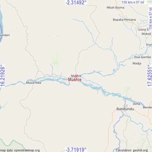
Mushie GPS coordinates[2]
3° 1' 2.208" South, 16° 55' 20.568" East
| Map corner | latitude | longitude |
|---|---|---|
| Upper-left | -2.31492°, | 16.21926° |
| Center: | -3.01728°, | 16.92238° |
| Lower-right: | -3.71919°, | 17.62551° |
| Map W x H: | 156.1×156.1 km | = 97×97mi |
| max Lat: | 4.279° ⇑44.3% North |
| Mushie: | -3.01728° |
| min Lat: | ⇓55.7% South -11.76097° |
| min Long | Mushie | max Long |
| 12.37148° | 16.92238° | 30.25224° |
| W 14.3%⇐ | ⇒85.7% E |
Elevation
Elevation of Mushie is 325 m = 1066 ft, and this is 331 m = 1086 ft below average elevation for this country.
| Max E: |
1996 m = 6549 ft | 84.3% |
| Avg. | 656 m = 2152 ft | |
| Mushie | 325 m = 1066 ft | |
Min E: |
11 m = 36 ft | 15.7% |
See also: Democratic Republic of the Congo elevation on elevation.city.
Geographical zone
Mushie is located in South Torrid zone (between Equator and Tropic of Capricorn). Distance of Equator is 335.5 km =208.5 mi to North.| Distance of | km | miles | from Mushie |
|---|---|---|---|
| Equator | 335.5 | 208.5 | to North |
| Tropic Capricorn | 2270.4 | 1410.8 | to South |
| Antarctic Circle | 7065.7 | 4390.4 | to South |
| South Pole | 9671.6 | 6009.7 | to South |


Nearby cities:
15 places around Mushie: (largest is in red/bold)
• Bandundu
60.8 km =37.8 mi,  123°
123°
• Bolobo
122.5 km =76.1 mi,  321°
321°
• Bulungu
252.2 km =156.7 mi,  132°
132°
• Ilebo
432 km =268.4 mi,  109°
109°
• Inongo
194.2 km =120.7 mi,  51°
51°
• Kasangulu
261.4 km =162.4 mi,  228°
228°
• Kasongo-Lunda
385 km =239.2 mi,  181°
181°
• Kikwit
307.8 km =191.3 mi,  136°
136°
• Kinshasa
230.4 km =143.2 mi, 230°
• Lukolela
219.5 km =136.4 mi,  7°
7°
• Mangai
310.7 km =193.1 mi, 111°
• Masina
227.9 km =141.6 mi, 228°
• Mbandaka
371.9 km =231.1 mi,  23°
23°
• Mbanza-Ngungu
338.3 km =210.2 mi,  222°
222°
• Nioki
91.4 km =56.8 mi,  68°
68°
Sources, notices
• [Note1] Compared only with cities in Democratic Republic of the Congo existing in our database
• [Src1] Map data: © OpenStreetMap contributors (CC-BY-SA)
• [Src2] Other city data from geonames.org with taken over terms of usage.
• [Src3] Geographical zone / Annual Mean Temperature by Robert A. Rohde @ Wikipedia
