Bandundu geodata
Bandundu (Kwilu) is a populated place; located in Democratic Republic of the Congo in Africa/Kinshasa (GMT+1) time zone. With population of 118,211 people, there are 23 cities with bigger population in this country. Compared to other cities in Democratic Republic of the Congo, 54.3% of cities are located further ↓South; 82.9% of cities are located further →East and 85.7% of cities have higher elevation than Bandundu. Note1


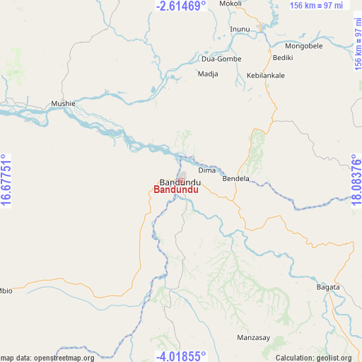
Bandundu GPS coordinates[2]
3° 19' 0.732" South, 17° 22' 50.268" East
| Map corner | latitude | longitude |
|---|---|---|
| Upper-left | -2.61469°, | 16.67751° |
| Center: | -3.31687°, | 17.38063° |
| Lower-right: | -4.01855°, | 18.08376° |
| Map W x H: | 156.1×156.1 km | = 97×97mi |
| max Lat: | 4.279° ⇑45.7% North |
| Bandundu: | -3.31687° |
| min Lat: | ⇓54.3% South -11.76097° |
| min Long | Bandundu | max Long |
| 12.37148° | 17.38063° | 30.25224° |
| W 17.1%⇐ | ⇒82.9% E |
Elevation
Elevation of Bandundu is 322 m = 1056 ft, and this is 334 m = 1096 ft below average elevation for this country.
| Max E: |
1996 m = 6549 ft | 85.7% |
| Avg. | 656 m = 2152 ft | |
| Bandundu | 322 m = 1056 ft | |
Min E: |
11 m = 36 ft | 14.3% |
See also: Bandundu elevation on elevation.city.
Geographical zone
Bandundu is located in South Torrid zone (between Equator and Tropic of Capricorn). Distance of Equator is 368.8 km =229.2 mi to North.| Distance of | km | miles | from Bandundu |
|---|---|---|---|
| Equator | 368.8 | 229.2 | to North |
| Tropic Capricorn | 2237.1 | 1390.1 | to South |
| Antarctic Circle | 7032.4 | 4369.7 | to South |
| South Pole | 9638.3 | 5989 | to South |


Nearby cities:
15 places around Bandundu: (largest is in red/bold)
• Bolobo
181.3 km =112.7 mi,  315°
315°
• Bulungu
192.4 km =119.6 mi,  135°
135°
• Ilebo
373.1 km =231.8 mi,  107°
107°
• Inongo
184.5 km =114.6 mi,  33°
33°
• Kasangulu
283.2 km =176 mi,  240°
240°
• Kasongo-Lunda
357 km =221.8 mi,  190°
190°
• Kikwit
249.2 km =154.8 mi, 140°
• Kinshasa
255.4 km =158.7 mi, 243°
• Lukolela
251.9 km =156.5 mi,  354°
354°
• Mangai
251.5 km =156.3 mi, 108°
• Masina
250.5 km =155.7 mi, 241°
• Mbandaka
386.8 km =240.3 mi,  14°
14°
• Mbanza-Ngungu
353.3 km =219.5 mi,  232°
232°
• Mushie
60.8 km =37.8 mi,  303°
303°
• Nioki
74.7 km =46.4 mi, 27°
Sources, notices
• [Note1] Compared only with cities in Democratic Republic of the Congo existing in our database
• [Src1] Map data: © OpenStreetMap contributors (CC-BY-SA)
• [Src2] Other city data from geonames.org with taken over terms of usage.
• [Src3] Geographical zone / Annual Mean Temperature by Robert A. Rohde @ Wikipedia
