Nioki geodata
Nioki (Mai-Ndombe) is a populated place; located in Democratic Republic of the Congo in Africa/Kinshasa (GMT+1) time zone. With population of 40,695 people, there are 43 cities with bigger population in this country. Compared to other cities in Democratic Republic of the Congo, 58.6% of cities are located further ↓South; 81.4% of cities are located further →East and 82.9% of cities have higher elevation than Nioki. Note1


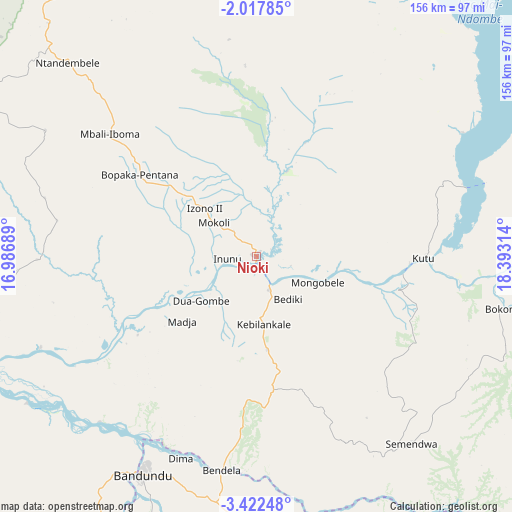
Nioki GPS coordinates[2]
2° 43' 13.332" South, 17° 41' 24.036" East
| Map corner | latitude | longitude |
|---|---|---|
| Upper-left | -2.01785°, | 16.98689° |
| Center: | -2.72037°, | 17.69001° |
| Lower-right: | -3.42248°, | 18.39314° |
| Map W x H: | 156.2×156.2 km | = 97.1×97.1mi |
| max Lat: | 4.279° ⇑41.4% North |
| Nioki: | -2.72037° |
| min Lat: | ⇓58.6% South -11.76097° |
| min Long | Nioki | max Long |
| 12.37148° | 17.69001° | 30.25224° |
| W 18.6%⇐ | ⇒81.4% E |
Elevation
Elevation of Nioki is 326 m = 1070 ft, and this is 330 m = 1083 ft below average elevation for this country.
| Max E: |
1996 m = 6549 ft | 82.9% |
| Avg. | 656 m = 2152 ft | |
| Nioki | 326 m = 1070 ft | |
Min E: |
11 m = 36 ft | 17.1% |
See also: Nioki elevation on elevation.city.
Geographical zone
Nioki is located in South Torrid zone (between Equator and Tropic of Capricorn). Distance of Equator is 302.5 km =188 mi to North.| Distance of | km | miles | from Nioki |
|---|---|---|---|
| Equator | 302.5 | 188 | to North |
| Tropic Capricorn | 2303.4 | 1431.3 | to South |
| Antarctic Circle | 7098.7 | 4410.9 | to South |
| South Pole | 9704.6 | 6030.2 | to South |


Nearby cities:
15 places around Nioki: (largest is in red/bold)
• Bandundu
74.7 km =46.4 mi,  207°
207°
• Bolobo
173.6 km =107.9 mi,  291°
291°
• Bulungu
226.7 km =140.9 mi,  153°
153°
• Ilebo
368 km =228.7 mi,  119°
119°
• Inongo
110.4 km =68.6 mi,  37°
37°
• Kasangulu
348.4 km =216.5 mi,  233°
233°
• Kasongo-Lunda
428.9 km =266.5 mi,  193°
193°
• Kikwit
286.7 km =178.1 mi, 154°
• Kinshasa
318.6 km =198 mi,  235°
235°
• Lukolela
193 km =119.9 mi,  342°
342°
• Mangai
250.7 km =155.8 mi,  125°
125°
• Masina
315.1 km =195.8 mi, 234°
• Mbandaka
314.3 km =195.3 mi,  11°
11°
• Mbanza-Ngungu
422.2 km =262.3 mi, 228°
• Mushie
91.4 km =56.8 mi,  248°
248°
Sources, notices
• [Note1] Compared only with cities in Democratic Republic of the Congo existing in our database
• [Src1] Map data: © OpenStreetMap contributors (CC-BY-SA)
• [Src2] Other city data from geonames.org with taken over terms of usage.
• [Src3] Geographical zone / Annual Mean Temperature by Robert A. Rohde @ Wikipedia
