Gemena geodata
Gemena (Équateur) is a populated place; located in Democratic Republic of the Congo in Africa/Kinshasa (GMT+1) time zone. With population of 117,639 people, there are 24 cities with bigger population in this country. Compared to other cities in Democratic Republic of the Congo, 92.9% of cities are located further ↓South; 71.4% of cities are located further →East and 61.4% of cities have higher elevation than Gemena. Note1


Gemena GPS coordinates[2]
3° 15' 23.436" North, 19° 46' 20.424" East
| Map corner | latitude | longitude |
|---|---|---|
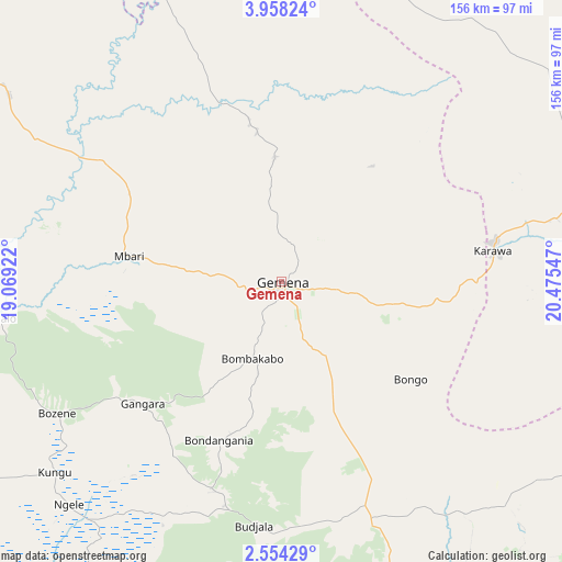
| Upper-left | 3.95824°, | 19.06922° |
| Center: | 3.25651°, | 19.77234° |
| Lower-right: | 2.55429°, | 20.47547° |
| Map W x H: | 156.1×156.1 km | = 97×97mi |
| max Lat: | 4.279° ⇑7.1% North |
| Gemena: | 3.25651° |
| min Lat: | ⇓92.9% South -11.76097° |
| min Long | Gemena | max Long |
| 12.37148° | 19.77234° | 30.25224° |
| W 28.6%⇐ | ⇒71.4% E |
Elevation
Elevation of Gemena is 420 m = 1378 ft, and this is 236 m = 774 ft below average elevation for this country.
| Max E: |
1996 m = 6549 ft | 61.4% |
| Avg. | 656 m = 2152 ft | |
| Gemena | 420 m = 1378 ft | |
Min E: |
11 m = 36 ft | 38.6% |
See also: Gemena elevation on elevation.city.
Geographical zone
Gemena is located in North Torrid zone (between Equator and Tropic of Cancer). Distance of Equator is 362.1 km =225 mi to South.| Distance of | km | miles | from Gemena |
|---|---|---|---|
| North Pole | 9645 | 5993.1 | to North |
| Arctic Circle | 7039.1 | 4373.9 | to North |
| Tropic Cancer | 2243.8 | 1394.2 | to North |
| Equator | 362.1 | 225 | to South |


Nearby cities:
10 places around Gemena: (largest is in red/bold)
• Boende
412.2 km =256.1 mi,  162°
162°
• Bondo
438.8 km =272.7 mi,  81°
81°
• Bongandanga
242.3 km =150.6 mi,  143°
143°
• Bosobolo
104.5 km =64.9 mi,  6°
6°
• Bumba
322.1 km =200.1 mi,  111°
111°
• Businga
123.9 km =77 mi,  85°
85°
• Gbadolite
177.7 km =110.4 mi,  50°
50°
• Libenge
133.6 km =83 mi,  289°
289°
• Lisala
229.4 km =142.5 mi,  122°
122°
• Mbandaka
394.3 km =245 mi,  205°
205°
Sources, notices
• [Note1] Compared only with cities in Democratic Republic of the Congo existing in our database
• [Src1] Map data: © OpenStreetMap contributors (CC-BY-SA)
• [Src2] Other city data from geonames.org with taken over terms of usage.
• [Src3] Geographical zone / Annual Mean Temperature by Robert A. Rohde @ Wikipedia
