Mbandaka geodata
Mbandaka (Équateur) is a seat of a first-order administrative division; located in Democratic Republic of the Congo in Africa/Kinshasa (GMT+1) time zone. With population of 184,185 people, there are 13 cities with bigger population in this country. Compared to other cities in Democratic Republic of the Congo, 71.4% of cities are located further ↓South; 80% of cities are located further →East and 91.4% of cities have higher elevation than Mbandaka. Note1


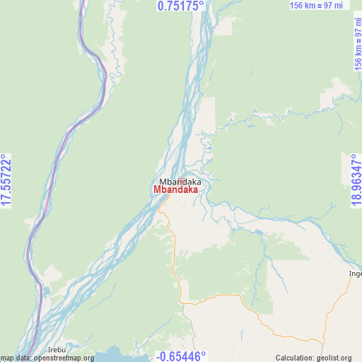
Mbandaka GPS coordinates[2]
0° 2' 55.14" North, 18° 15' 37.224" East
| Map corner | latitude | longitude |
|---|---|---|
| Upper-left | 0.75175°, | 17.55722° |
| Center: | 0.04865°, | 18.26034° |
| Lower-right: | -0.65446°, | 18.96347° |
| Map W x H: | 156.4×156.4 km | = 97.2×97.2mi |
| max Lat: | 4.279° ⇑28.6% North |
| Mbandaka: | 0.04865° |
| min Lat: | ⇓71.4% South -11.76097° |
| min Long | Mbandaka | max Long |
| 12.37148° | 18.26034° | 30.25224° |
| W 20%⇐ | ⇒80% E |
Elevation
Elevation of Mbandaka is 315 m = 1033 ft, and this is 341 m = 1119 ft below average elevation for this country.
| Max E: |
1996 m = 6549 ft | 91.4% |
| Avg. | 656 m = 2152 ft | |
| Mbandaka | 315 m = 1033 ft | |
Min E: |
11 m = 36 ft | 8.6% |
See also: Mbandaka elevation on elevation.city.
Geographical zone
Mbandaka is located in North Torrid zone (between Equator and Tropic of Cancer). Distance of Equator is 5.4 km =3.4 mi to South.| Distance of | km | miles | from Mbandaka |
|---|---|---|---|
| North Pole | 10001.7 | 6214.8 | to North |
| Arctic Circle | 7395.8 | 4595.5 | to North |
| Tropic Cancer | 2600.5 | 1615.9 | to North |
| Equator | 5.4 | 3.4 | to South |


Nearby cities:
11 places around Mbandaka: (largest is in red/bold)
• Bandundu
386.8 km =240.3 mi,  194°
194°
• Boende
293.6 km =182.4 mi,  97°
97°
• Bolobo
333.2 km =207 mi,  222°
222°
• Bongandanga
352.2 km =218.8 mi,  62°
62°
• Gemena
394.3 km =245 mi,  25°
25°
• Inongo
219.7 km =136.5 mi,  179°
179°
• Libenge
403 km =250.4 mi,  5°
5°
• Lisala
430.9 km =267.7 mi, 57°
• Lukolela
172 km =106.9 mi, 224°
• Mushie
371.9 km =231.1 mi,  203°
203°
• Nioki
314.3 km =195.3 mi, 191°
Sources, notices
• [Note1] Compared only with cities in Democratic Republic of the Congo existing in our database
• [Src1] Map data: © OpenStreetMap contributors (CC-BY-SA)
• [Src2] Other city data from geonames.org with taken over terms of usage.
• [Src3] Geographical zone / Annual Mean Temperature by Robert A. Rohde @ Wikipedia
