Ouango geodata
Ouango (Mbomou) is a populated place; located in Central African Republic in Africa/Bangui (GMT+1) time zone. With population of 4,365 people, there are 35 cities with bigger population in this country. Compared to other cities in Central African Republic, 82.9% of cities are located further ↑North; 88.6% of cities are located further ←West and 80% of cities have higher elevation than Ouango. Note1


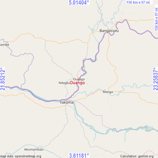
Ouango GPS coordinates[2]
4° 18' 47.7" North, 22° 33' 18.864" East
| Map corner | latitude | longitude |
|---|---|---|
| Upper-left | 5.01404°, | 21.85212° |
| Center: | 4.31325°, | 22.55524° |
| Lower-right: | 3.61181°, | 23.25837° |
| Map W x H: | 155.9×155.9 km | = 96.9×96.9mi |
| max Lat: | 10.28488° ⇑82.9% North |
| Ouango: | 4.31325° |
| min Lat: | ⇓17.1% South 3.52494° |
| min Long | Ouango | max Long |
| 15.13926° | 22.55524° | 26.49211° |
| W 88.6%⇐ | ⇒11.4% E |
Elevation
Elevation of Ouango is 409 m = 1342 ft, and this is 96.3 m = 316 ft below average elevation for this country.
| Max E: |
976 m = 3202 ft | 80% |
| Avg. | 505.3 m = 1658 ft | |
| Ouango | 409 m = 1342 ft | |
Min E: |
351 m = 1152 ft | 20% |
See also: Central African Republic elevation on elevation.city.
Geographical zone
Ouango is located in North Torrid zone (between Equator and Tropic of Cancer). Distance of Equator is 479.6 km =298 mi to South.| Distance of | km | miles | from Ouango |
|---|---|---|---|
| North Pole | 9527.5 | 5920.1 | to North |
| Arctic Circle | 6921.6 | 4300.9 | to North |
| Tropic Cancer | 2126.3 | 1321.2 | to North |
| Equator | 479.6 | 298 | to South |


Nearby cities:
13 places around Ouango: (largest is in red/bold)
• Alindao
169 km =105 mi,  297°
297°
• Bambari
263.6 km =163.8 mi,  307°
307°
• Bangassou
55.8 km =34.7 mi,  31°
31°
• Bria
255.7 km =158.9 mi,  345°
345°
• Damara
432.9 km =269 mi,  279°
279°
• Gambo
49.3 km =30.6 mi,  319°
319°
• Ippy
262.6 km =163.2 mi,  325°
325°
• Kembé
81.7 km =50.8 mi,  294°
294°
• Kouango
297.2 km =184.7 mi, 284°
• Mobaye
152.6 km =94.8 mi,  270°
270°
• Ouadda
418.9 km =260.3 mi,  357°
357°
• Sibut
416 km =258.5 mi, 292°
• Zemio
297 km =184.5 mi,  74°
74°
Sources, notices
• [Note1] Compared only with cities in Central African Republic existing in our database
• [Src1] Map data: © OpenStreetMap contributors (CC-BY-SA)
• [Src2] Other city data from geonames.org with taken over terms of usage.
• [Src3] Geographical zone / Annual Mean Temperature by Robert A. Rohde @ Wikipedia
