Gambo geodata
Gambo (Mbomou) is a populated place; located in Central African Republic in Africa/Bangui (GMT+1) time zone. With population of 4,971 people, there are 34 cities with bigger population in this country. Compared to other cities in Central African Republic, 68.6% of cities are located further ↑North; 82.9% of cities are located further ←West and 54.3% of cities have lower elevation than Gambo. Note1


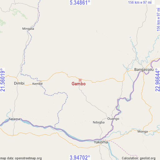
Gambo GPS coordinates[2]
4° 38' 53.376" North, 22° 15' 47.916" East
| Map corner | latitude | longitude |
|---|---|---|
| Upper-left | 5.34861°, | 21.56019° |
| Center: | 4.64816°, | 22.26331° |
| Lower-right: | 3.94702°, | 22.96644° |
| Map W x H: | 155.8×155.8 km | = 96.8×96.8mi |
| max Lat: | 10.28488° ⇑68.6% North |
| Gambo: | 4.64816° |
| min Lat: | ⇓31.4% South 3.52494° |
| min Long | Gambo | max Long |
| 15.13926° | 22.26331° | 26.49211° |
| W 82.9%⇐ | ⇒17.1% E |
Elevation
Elevation of Gambo is 483 m = 1585 ft, and this is 22.3 m = 73 ft below average elevation for this country.
| Max E: |
976 m = 3202 ft | 45.7% |
| Avg. | 505.3 m = 1658 ft | |
| Gambo | 483 m = 1585 ft | |
Min E: |
351 m = 1152 ft | 54.3% |
See also: Central African Republic elevation on elevation.city.
Geographical zone
Gambo is located in North Torrid zone (between Equator and Tropic of Cancer). Distance of Equator is 516.8 km =321.1 mi to South.| Distance of | km | miles | from Gambo |
|---|---|---|---|
| North Pole | 9490.2 | 5896.9 | to North |
| Arctic Circle | 6884.3 | 4277.7 | to North |
| Tropic Cancer | 2089.1 | 1298.1 | to North |
| Equator | 516.8 | 321.1 | to South |


Nearby cities:
15 places around Gambo: (largest is in red/bold)
• Alindao
124.2 km =77.2 mi,  289°
289°
• Bambari
215.4 km =133.8 mi,  305°
305°
• Bangassou
62.4 km =38.8 mi,  80°
80°
• Bangui
412.3 km =256.2 mi,  265°
265°
• Bria
212.8 km =132.2 mi,  351°
351°
• Damara
396 km =246.1 mi,  275°
275°
• Ippy
213.7 km =132.8 mi,  327°
327°
• Kembé
41.9 km =26 mi, 266°
• Kouango
257.9 km =160.3 mi, 278°
• Mobaye
125.7 km =78.1 mi,  253°
253°
• Mongoumba
422.1 km =262.3 mi, 254°
• Ouadda
381.6 km =237.1 mi,  2°
2°
• Ouango
49.3 km =30.6 mi,  139°
139°
• Sibut
372.7 km =231.6 mi, 288°
• Zemio
321.1 km =199.5 mi, 82°
Sources, notices
• [Note1] Compared only with cities in Central African Republic existing in our database
• [Src1] Map data: © OpenStreetMap contributors (CC-BY-SA)
• [Src2] Other city data from geonames.org with taken over terms of usage.
• [Src3] Geographical zone / Annual Mean Temperature by Robert A. Rohde @ Wikipedia
