Kouango geodata
Kouango (Ouaka) is a populated place; located in Central African Republic in Africa/Bangui (GMT+1) time zone. With population of 7,529 people, there are 30 cities with bigger population in this country. Compared to other cities in Central African Republic, 54.3% of cities are located further ↑North; 60% of cities are located further ←West and 94.3% of cities have higher elevation than Kouango. Note1


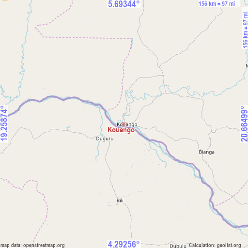
Kouango GPS coordinates[2]
4° 59' 36.132" North, 19° 57' 42.696" East
| Map corner | latitude | longitude |
|---|---|---|
| Upper-left | 5.69344°, | 19.25874° |
| Center: | 4.99337°, | 19.96186° |
| Lower-right: | 4.29256°, | 20.66499° |
| Map W x H: | 155.8×155.8 km | = 96.8×96.8mi |
| max Lat: | 10.28488° ⇑54.3% North |
| Kouango: | 4.99337° |
| min Lat: | ⇓45.7% South 3.52494° |
| min Long | Kouango | max Long |
| 15.13926° | 19.96186° | 26.49211° |
| W 60%⇐ | ⇒40% E |
Elevation
Elevation of Kouango is 363 m = 1191 ft, and this is 142.3 m = 467 ft below average elevation for this country.
| Max E: |
976 m = 3202 ft | 94.3% |
| Avg. | 505.3 m = 1658 ft | |
| Kouango | 363 m = 1191 ft | |
Min E: |
351 m = 1152 ft | 5.7% |
See also: Central African Republic elevation on elevation.city.
Geographical zone
Kouango is located in North Torrid zone (between Equator and Tropic of Cancer). Distance of Equator is 555.2 km =345 mi to South.| Distance of | km | miles | from Kouango |
|---|---|---|---|
| North Pole | 9451.9 | 5873.1 | to North |
| Arctic Circle | 6846 | 4253.9 | to North |
| Tropic Cancer | 2050.7 | 1274.2 | to North |
| Equator | 555.2 | 345 | to South |


Nearby cities:
15 places around Kouango: (largest is in red/bold)
• Alindao
138.2 km =85.9 mi,  88°
88°
• Bambari
116.9 km =72.6 mi,  42°
42°
• Bangui
171 km =106.3 mi,  245°
245°
• Bimbo
189.9 km =118 mi,  244°
244°
• Boali
204.3 km =126.9 mi,  263°
263°
• Bouca
251.2 km =156.1 mi,  312°
312°
• Damara
139.4 km =86.6 mi,  268°
268°
• Gambo
257.9 km =160.3 mi,  98°
98°
• Ippy
199 km =123.7 mi, 44°
• Kaga Bandoro
237.9 km =147.8 mi,  338°
338°
• Kembé
217.2 km =135 mi, 100°
• Mbaïki
252 km =156.6 mi, 240°
• Mobaye
154.3 km =95.9 mi,  119°
119°
• Mongoumba
213.6 km =132.7 mi,  225°
225°
• Sibut
127.1 km =79 mi, 309°
Sources, notices
• [Note1] Compared only with cities in Central African Republic existing in our database
• [Src1] Map data: © OpenStreetMap contributors (CC-BY-SA)
• [Src2] Other city data from geonames.org with taken over terms of usage.
• [Src3] Geographical zone / Annual Mean Temperature by Robert A. Rohde @ Wikipedia
