Alindao geodata
Alindao (Basse-Kotto) is a populated place; located in Central African Republic in Africa/Bangui (GMT+1) time zone. With population of 14,234 people, there are 20 cities with bigger population in this country. Compared to other cities in Central African Republic, 51.4% of cities are located further ↑North; 71.4% of cities are located further ←West and 62.9% of cities have higher elevation than Alindao. Note1


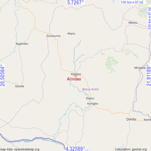
Alindao GPS coordinates[2]
5° 1' 36.012" North, 21° 12' 31.536" East
| Map corner | latitude | longitude |
|---|---|---|
| Upper-left | 5.7267°, | 20.50564° |
| Center: | 5.02667°, | 21.20876° |
| Lower-right: | 4.32589°, | 21.91189° |
| Map W x H: | 155.8×155.8 km | = 96.8×96.8mi |
| max Lat: | 10.28488° ⇑51.4% North |
| Alindao: | 5.02667° |
| min Lat: | ⇓48.6% South 3.52494° |
| min Long | Alindao | max Long |
| 15.13926° | 21.20876° | 26.49211° |
| W 71.4%⇐ | ⇒28.6% E |
Elevation
Elevation of Alindao is 441 m = 1447 ft, and this is 64.3 m = 211 ft below average elevation for this country.
| Max E: |
976 m = 3202 ft | 62.9% |
| Avg. | 505.3 m = 1658 ft | |
| Alindao | 441 m = 1447 ft | |
Min E: |
351 m = 1152 ft | 37.1% |
See also: Central African Republic elevation on elevation.city.
Geographical zone
Alindao is located in North Torrid zone (between Equator and Tropic of Cancer). Distance of Equator is 558.9 km =347.3 mi to South.| Distance of | km | miles | from Alindao |
|---|---|---|---|
| North Pole | 9448.1 | 5870.8 | to North |
| Arctic Circle | 6842.3 | 4251.6 | to North |
| Tropic Cancer | 2047 | 1271.9 | to North |
| Equator | 558.9 | 347.3 | to South |


Nearby cities:
15 places around Alindao: (largest is in red/bold)
• Bambari
101.4 km =63 mi,  324°
324°
• Bangassou
181.1 km =112.5 mi,  100°
100°
• Bangui
303.2 km =188.4 mi,  255°
255°
• Bimbo
321.1 km =199.5 mi,  254°
254°
• Bria
189.2 km =117.6 mi,  27°
27°
• Damara
277.6 km =172.5 mi,  268°
268°
• Gambo
124.2 km =77.2 mi,  109°
109°
• Ippy
138 km =85.7 mi,  0°
0°
• Kaga Bandoro
312.4 km =194.1 mi,  314°
314°
• Kembé
87.5 km =54.4 mi,  120°
120°
• Kouango
138.2 km =85.9 mi, 268°
• Mobaye
78.8 km =49 mi,  182°
182°
• Mongoumba
328.3 km =204 mi,  242°
242°
• Ouango
169 km =105 mi, 117°
• Sibut
248.5 km =154.4 mi,  288°
288°
Sources, notices
• [Note1] Compared only with cities in Central African Republic existing in our database
• [Src1] Map data: © OpenStreetMap contributors (CC-BY-SA)
• [Src2] Other city data from geonames.org with taken over terms of usage.
• [Src3] Geographical zone / Annual Mean Temperature by Robert A. Rohde @ Wikipedia
