Ouadda geodata
Ouadda (Haute-Kotto) is a populated place; located in Central African Republic in Africa/Bangui (GMT+1) time zone. With population of 5,434 people, there are 33 cities with bigger population in this country. Compared to other cities in Central African Republic, 94.3% of cities are located further ↓South; 85.7% of cities are located further ←West and 94.3% of cities have lower elevation than Ouadda. Note1


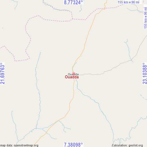
Ouadda GPS coordinates[2]
8° 4' 39.756" North, 22° 24' 2.7" East
| Map corner | latitude | longitude |
|---|---|---|
| Upper-left | 8.77324°, | 21.69763° |
| Center: | 8.07771°, | 22.40075° |
| Lower-right: | 7.38098°, | 23.10388° |
| Map W x H: | 154.8×154.8 km | = 96.2×96.2mi |
| max Lat: | 10.28488° ⇑5.7% North |
| Ouadda: | 8.07771° |
| min Lat: | ⇓94.3% South 3.52494° |
| min Long | Ouadda | max Long |
| 15.13926° | 22.40075° | 26.49211° |
| W 85.7%⇐ | ⇒14.3% E |
Elevation
Elevation of Ouadda is 710 m = 2329 ft, and this is 204.7 m = 672 ft above average elevation for this country.
| Max E: |
976 m = 3202 ft | 5.7% |
| Ouadda | 710 m 2329 ft | |
| Avg. | 505.3 m = 1658 ft | |
Min E: |
351 m = 1152 ft | 94.3% |
See also: Central African Republic elevation on elevation.city.
Geographical zone
Ouadda is located in North Torrid zone (between Equator and Tropic of Cancer). Distance of Equator is 898.2 km =558.1 mi to South.| Distance of | km | miles | from Ouadda |
|---|---|---|---|
| North Pole | 9108.9 | 5660 | to North |
| Arctic Circle | 6503 | 4040.8 | to North |
| Tropic Cancer | 1707.8 | 1061.2 | to North |
| Equator | 898.2 | 558.1 | to South |


Nearby cities:
14 places around Ouadda: (largest is in red/bold)
• Alindao
363.9 km =226.1 mi,  201°
201°
• Bambari
319.7 km =198.7 mi,  216°
216°
• Bangassou
373.8 km =232.3 mi,  172°
172°
• Birao
249.1 km =154.8 mi,  9°
9°
• Bria
176.7 km =109.8 mi,  194°
194°
• Gambo
381.6 km =237.1 mi,  182°
182°
• Ippy
239.4 km =148.8 mi,  212°
212°
• Kabo
417.5 km =259.4 mi,  264°
264°
• Kaga Bandoro
374.3 km =232.6 mi,  251°
251°
• Kembé
388.3 km =241.3 mi, 188°
• Kouango
436.1 km =271 mi, 218°
• Mobaye
439.2 km =272.9 mi, 197°
• Ndélé
196.5 km =122.1 mi,  280°
280°
• Ouango
418.9 km =260.3 mi, 177°
Sources, notices
• [Note1] Compared only with cities in Central African Republic existing in our database
• [Src1] Map data: © OpenStreetMap contributors (CC-BY-SA)
• [Src2] Other city data from geonames.org with taken over terms of usage.
• [Src3] Geographical zone / Annual Mean Temperature by Robert A. Rohde @ Wikipedia
