Ippy geodata
Ippy (Ouaka) is a populated place; located in Central African Republic in Africa/Bangui (GMT+1) time zone. With population of 16,571 people, there are 18 cities with bigger population in this country. Compared to other cities in Central African Republic, 68.6% of cities are located further ↓South; 74.3% of cities are located further ←West and 80% of cities have lower elevation than Ippy. Note1


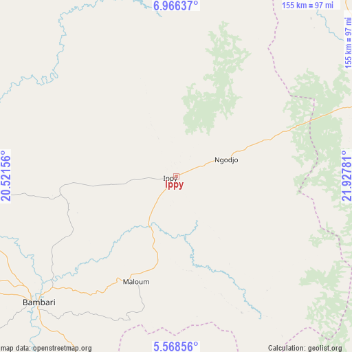
Ippy GPS coordinates[2]
6° 16' 4.548" North, 21° 13' 28.848" East
| Map corner | latitude | longitude |
|---|---|---|
| Upper-left | 6.96637°, | 20.52156° |
| Center: | 6.26793°, | 21.22468° |
| Lower-right: | 5.56856°, | 21.92781° |
| Map W x H: | 155.4×155.4 km | = 96.6×96.6mi |
| max Lat: | 10.28488° ⇑31.4% North |
| Ippy: | 6.26793° |
| min Lat: | ⇓68.6% South 3.52494° |
| min Long | Ippy | max Long |
| 15.13926° | 21.22468° | 26.49211° |
| W 74.3%⇐ | ⇒25.7% E |
Elevation
Elevation of Ippy is 596 m = 1955 ft, and this is 90.7 m = 298 ft above average elevation for this country.
| Max E: |
976 m = 3202 ft | 20% |
| Ippy | 596 m 1955 ft | |
| Avg. | 505.3 m = 1658 ft | |
Min E: |
351 m = 1152 ft | 80% |
See also: Central African Republic elevation on elevation.city.
Geographical zone
Ippy is located in North Torrid zone (between Equator and Tropic of Cancer). Distance of Equator is 696.9 km =433 mi to South.| Distance of | km | miles | from Ippy |
|---|---|---|---|
| North Pole | 9310.1 | 5785 | to North |
| Arctic Circle | 6704.2 | 4165.8 | to North |
| Tropic Cancer | 1909 | 1186.2 | to North |
| Equator | 696.9 | 433 | to South |


Nearby cities:
15 places around Ippy: (largest is in red/bold)
• Alindao
138 km =85.7 mi,  180°
180°
• Bambari
82.3 km =51.1 mi,  227°
227°
• Bangassou
244.8 km =152.1 mi,  133°
133°
• Bouca
326.8 km =203.1 mi,  274°
274°
• Bria
89.5 km =55.6 mi,  70°
70°
• Damara
314.6 km =195.5 mi,  242°
242°
• Gambo
213.7 km =132.8 mi,  147°
147°
• Kaga Bandoro
238.9 km =148.4 mi,  289°
289°
• Kembé
197 km =122.4 mi,  158°
158°
• Kouango
199 km =123.7 mi,  224°
224°
• Mobaye
216.8 km =134.7 mi, 181°
• Ndélé
246.6 km =153.2 mi,  345°
345°
• Ouadda
239.4 km =148.8 mi,  32°
32°
• Ouango
262.6 km =163.2 mi, 145°
• Sibut
245.6 km =152.6 mi,  255°
255°
Sources, notices
• [Note1] Compared only with cities in Central African Republic existing in our database
• [Src1] Map data: © OpenStreetMap contributors (CC-BY-SA)
• [Src2] Other city data from geonames.org with taken over terms of usage.
• [Src3] Geographical zone / Annual Mean Temperature by Robert A. Rohde @ Wikipedia
