Rünenberg geodata
Rünenberg (Basel-Landschaft) is a populated place; located in Switzerland in Europe/Zurich (GMT+2) time zone. With population of 762 people, there are 1519 cities with bigger population in this country. Compared to other cities in Switzerland, 79.9% of cities are located further ↓South; 63% of cities are located further →East and 73.3% of cities have lower elevation than Rünenberg. Note1


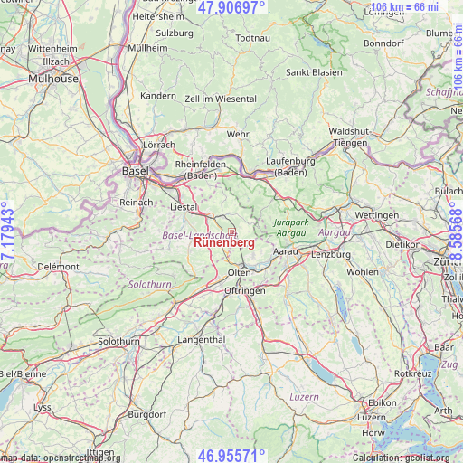
Rünenberg GPS coordinates[2]
47° 26' 0.564" North, 7° 52' 57.18" East
| Map corner | latitude | longitude |
|---|---|---|
| Upper-left | 47.90697°, | 7.17943° |
| Center: | 47.43349°, | 7.88255° |
| Lower-right: | 46.95571°, | 8.58568° |
| Map W x H: | 105.8×105.8 km | = 65.7×65.7mi |
| max Lat: | 47.76737° ⇑20.1% North |
| Rünenberg: | 47.43349° |
| min Lat: | ⇓79.9% South 45.83203° |
| min Long | Rünenberg | max Long |
| 5.97153° | 7.88255° | 10.44624° |
| W 37%⇐ | ⇒63% E |
Elevation
Elevation of Rünenberg is 600 m = 1969 ft, and this is 41.8 m = 137 ft above average elevation for this country.
| Max E: |
1845 m = 6053 ft | 26.7% |
| Rünenberg | 600 m 1969 ft | |
| Avg. | 558.2 m = 1831 ft | |
Min E: |
197 m = 646 ft | 73.3% |
See also: Switzerland elevation on elevation.city.
Geographical zone
Rünenberg is located in North temperate zone (between Tropic of Cancer and the Arctic Circle). Distance of this North polar circle is 2127.1 km =1321.7 mi to North.| Distance of | km | miles | from Rünenberg |
|---|---|---|---|
| North Pole | 4733 | 2940.9 | to North |
| Arctic Circle | 2127.1 | 1321.7 | to North |
| Tropic Cancer | 2668.2 | 1657.9 | to South |
| Equator | 5274.1 | 3277.2 | to South |


Nearby cities:
15 places around Rünenberg: (largest is in red/bold)
• Buckten
3.9 km =2.4 mi,  227°
227°
• Diegten
5.8 km =3.6 mi,  247°
247°
• Gelterkinden
4.2 km =2.6 mi,  326°
326°
• Känerkinden
4.2 km =2.6 mi, 234°
• Lostorf
7.3 km =4.5 mi,  138°
138°
• Läufelfingen
4.8 km =3 mi,  204°
204°
• Ormalingen
4.1 km =2.5 mi,  349°
349°
• Rohr
5.9 km =3.7 mi,  115°
115°
• Sissach
6.5 km =4 mi,  301°
301°
• Tecknau
1.7 km =1.1 mi,  5°
5°
• Tenniken
5.4 km =3.4 mi,  274°
274°
• Trimbach
7.6 km =4.7 mi,  177°
177°
• Wegenstetten
8.1 km =5 mi,  27°
27°
• Zeglingen
2.5 km =1.6 mi, 135°
• Zunzgen
5.9 km =3.7 mi,  287°
287°
Sources, notices
• [Note1] Compared only with cities in Switzerland existing in our database
• [Src1] Map data: © OpenStreetMap contributors (CC-BY-SA)
• [Src2] Other city data from geonames.org with taken over terms of usage.
• [Src3] Geographical zone / Annual Mean Temperature by Robert A. Rohde @ Wikipedia
