Olten geodata
Olten (Solothurn) is a seat of a second-order administrative division; located in Switzerland in Europe/Zurich (GMT+2) time zone. With population of 16,411 people, there are 62 cities with bigger population in this country. Compared to other cities in Switzerland, 64.7% of cities are located further ↓South; 62.3% of cities are located further →East and 86.6% of cities have higher elevation than Olten. Note1


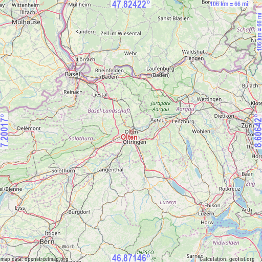
Olten GPS coordinates[2]
47° 20' 59.964" North, 7° 54' 11.844" East
| Map corner | latitude | longitude |
|---|---|---|
| Upper-left | 47.82422°, | 7.20017° |
| Center: | 47.34999°, | 7.90329° |
| Lower-right: | 46.87146°, | 8.60642° |
| Map W x H: | 105.9×105.9 km | = 65.8×65.8mi |
| max Lat: | 47.76737° ⇑35.3% North |
| Olten: | 47.34999° |
| min Lat: | ⇓64.7% South 45.83203° |
| min Long | Olten | max Long |
| 5.97153° | 7.90329° | 10.44624° |
| W 37.7%⇐ | ⇒62.3% E |
Elevation
Elevation of Olten is 406 m = 1332 ft, and this is 152.2 m = 499 ft below average elevation for this country.
| Max E: |
1845 m = 6053 ft | 86.6% |
| Avg. | 558.2 m = 1831 ft | |
| Olten | 406 m = 1332 ft | |
Min E: |
197 m = 646 ft | 13.4% |
See also: Switzerland elevation on elevation.city.
Geographical zone
Olten is located in North temperate zone (between Tropic of Cancer and the Arctic Circle). Distance of this North polar circle is 2136.3 km =1327.4 mi to North.| Distance of | km | miles | from Olten |
|---|---|---|---|
| North Pole | 4742.2 | 2946.7 | to North |
| Arctic Circle | 2136.3 | 1327.4 | to North |
| Tropic Cancer | 2658.9 | 1652.2 | to South |
| Equator | 5264.8 | 3271.4 | to South |


Nearby cities:
15 places around Olten: (largest is in red/bold)
• Aarburg
3.3 km =2.1 mi,  184°
184°
• Gunzgen
6.8 km =4.2 mi,  233°
233°
• Hägendorf
5 km =3.1 mi,  250°
250°
• Lostorf
5 km =3.1 mi,  40°
40°
• Läufelfingen
6.1 km =3.8 mi,  324°
324°
• Niedergösgen
6.8 km =4.2 mi,  69°
69°
• Obergösgen
4 km =2.5 mi,  64°
64°
• Oftringen
4.4 km =2.7 mi,  157°
157°
• Rohr
7.7 km =4.8 mi,  29°
29°
• Rothrist
5.1 km =3.2 mi,  189°
189°
• Safenwil
6.8 km =4.2 mi,  117°
117°
• Trimbach
2.1 km =1.3 mi, 324°
• Wangen
2.6 km =1.6 mi, 254°
• Zeglingen
7.5 km =4.7 mi,  1°
1°
• Zofingen
7.6 km =4.7 mi, 155°
Sources, notices
• [Note1] Compared only with cities in Switzerland existing in our database
• [Src1] Map data: © OpenStreetMap contributors (CC-BY-SA)
• [Src2] Other city data from geonames.org with taken over terms of usage.
• [Src3] Geographical zone / Annual Mean Temperature by Robert A. Rohde @ Wikipedia
