Yakassé-Attobrou geodata
Yakassé-Attobrou (Lagunes) is a seat of a third-order administrative division; located in Ivory Coast in Africa/Abidjan (GMT+0) time zone. In our database, there are 63 cities with bigger population. Compared to other cities in Ivory Coast, 70.9% of cities are located further ↑North; 86.3% of cities are located further ←West and 68.4% of cities have higher elevation than Yakassé-Attobrou. Note1


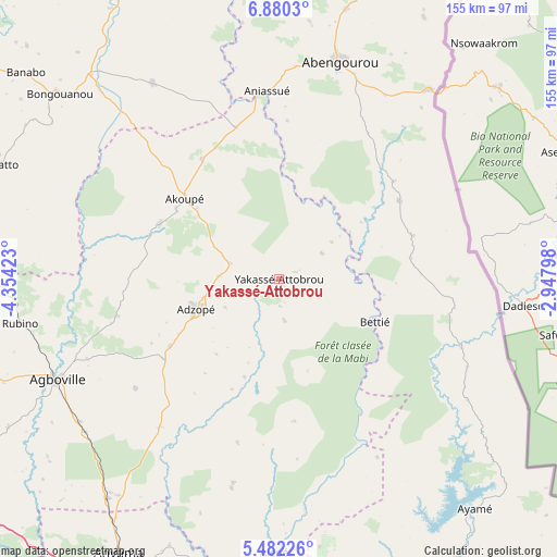
Yakassé-Attobrou GPS coordinates[2]
6° 10' 54.264" North, 3° 39' 3.996" West
| Map corner | latitude | longitude |
|---|---|---|
| Upper-left | 6.8803°, | -4.35423° |
| Center: | 6.18174°, | -3.65111° |
| Lower-right: | 5.48226°, | -2.94798° |
| Map W x H: | 155.4×155.5 km | = 96.6×96.6mi |
| max Lat: | 10.48115° ⇑70.9% North |
| Yakassé-Attobrou: | 6.18174° |
| min Lat: | ⇓29.1% South 4.42295° |
| min Long | Yakassé-Attobr | max Long |
| -8.42592° | -3.65111° | -2.80003° |
| W 86.3%⇐ | ⇒13.7% E |
Elevation
Elevation of Yakassé-Attobrou is 144 m = 472 ft, and this is 80.3 m = 263 ft below average elevation for this country.
| Max E: |
556 m = 1824 ft | 68.4% |
| Avg. | 224.3 m = 736 ft | |
| Yakassé-Attobrou | 144 m = 472 ft | |
Min E: |
7 m = 23 ft | 31.6% |
See also: Ivory Coast elevation on elevation.city.
Geographical zone
Yakassé-Attobrou is located in North Torrid zone (between Equator and Tropic of Cancer). Distance of Equator is 687.3 km =427.1 mi to South.| Distance of | km | miles | from Yakassé-Attobrou |
|---|---|---|---|
| North Pole | 9319.7 | 5791 | to North |
| Arctic Circle | 6713.8 | 4171.8 | to North |
| Tropic Cancer | 1918.6 | 1192.2 | to North |
| Equator | 687.3 | 427.1 | to South |


Nearby cities:
15 places around Yakassé-Attobrou: (largest is in red/bold)
• Abengourou
63.3 km =39.3 mi,  15°
15°
• Aboisso
93.3 km =58 mi,  148°
148°
• Adzopé
24.7 km =15.3 mi,  250°
250°
• Affery
36.7 km =22.8 mi,  294°
294°
• Agboville
68.3 km =42.4 mi, 245°
• Agou
39.2 km =24.4 mi,  235°
235°
• Akoupé
34.5 km =21.4 mi,  310°
310°
• Alépé
75.8 km =47.1 mi,  181°
181°
• Anyama
88.3 km =54.9 mi,  210°
210°
• Arrah
65 km =40.4 mi,  327°
327°
• Ayamé
84.2 km =52.3 mi,  139°
139°
• Azaguié
77.7 km =48.3 mi,  217°
217°
• Bongouanou
80.4 km =50 mi, 310°
• Béttié
29.3 km =18.2 mi,  113°
113°
• M’Batto
84.5 km =52.5 mi, 292°
Sources, notices
• [Note1] Compared only with cities in Ivory Coast existing in our database
• [Src1] Map data: © OpenStreetMap contributors (CC-BY-SA)
• [Src2] Other city data from geonames.org with taken over terms of usage.
• [Src3] Geographical zone / Annual Mean Temperature by Robert A. Rohde @ Wikipedia
