Sandégué geodata
Sandégué (Zanzan) is a seat of a third-order administrative division; located in Ivory Coast in Africa/Abidjan (GMT+0) time zone. In our database, there are 63 cities with bigger population. Compared to other cities in Ivory Coast, 73.5% of cities are located further ↓South; 88% of cities are located further ←West and 58.1% of cities have higher elevation than Sandégué. Note1


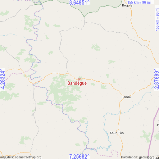
Sandégué GPS coordinates[2]
7° 57' 13.536" North, 3° 34' 48.432" West
| Map corner | latitude | longitude |
|---|---|---|
| Upper-left | 8.64951°, | -4.28324° |
| Center: | 7.95376°, | -3.58012° |
| Lower-right: | 7.25682°, | -2.87699° |
| Map W x H: | 154.9×154.9 km | = 96.3×96.3mi |
| max Lat: | 10.48115° ⇑26.5% North |
| Sandégué: | 7.95376° |
| min Lat: | ⇓73.5% South 4.42295° |
| min Long | Sandégué | max Long |
| -8.42592° | -3.58012° | -2.80003° |
| W 88%⇐ | ⇒12% E |
Elevation
Elevation of Sandégué is 201 m = 659 ft, and this is 23.3 m = 76 ft below average elevation for this country.
| Max E: |
556 m = 1824 ft | 58.1% |
| Avg. | 224.3 m = 736 ft | |
| Sandégué | 201 m = 659 ft | |
Min E: |
7 m = 23 ft | 41.9% |
See also: Ivory Coast elevation on elevation.city.
Geographical zone
Sandégué is located in North Torrid zone (between Equator and Tropic of Cancer). Distance of Equator is 884.4 km =549.5 mi to South.| Distance of | km | miles | from Sandégué |
|---|---|---|---|
| North Pole | 9122.7 | 5668.6 | to North |
| Arctic Circle | 6516.8 | 4049.4 | to North |
| Tropic Cancer | 1721.5 | 1069.7 | to North |
| Equator | 884.4 | 549.5 | to South |


Nearby cities:
15 places around Sandégué: (largest is in red/bold)
• Abengourou
136.4 km =84.8 mi,  176°
176°
• Agnibilékrou
100.4 km =62.4 mi,  155°
155°
• Arrah
148.7 km =92.4 mi,  196°
196°
• Bocanda
141.7 km =88 mi,  225°
225°
• Bondoukou
86.4 km =53.7 mi,  83°
83°
• Bouna
159.8 km =99.3 mi,  23°
23°
• Dabakala
103.9 km =64.6 mi,  295°
295°
• Daoukro
108.1 km =67.2 mi, 202°
• Kouassi-Kouassikro
138.7 km =86.2 mi,  240°
240°
• Koun-Fao
63.2 km =39.3 mi,  145°
145°
• M’Bahiakro
100.3 km =62.3 mi, 236°
• Nassian
56.8 km =35.3 mi,  12°
12°
• Prikro
57.1 km =35.5 mi, 233°
• Tanda
48.3 km =30 mi,  110°
110°
• Transua
76.8 km =47.7 mi,  125°
125°
Sources, notices
• [Note1] Compared only with cities in Ivory Coast existing in our database
• [Src1] Map data: © OpenStreetMap contributors (CC-BY-SA)
• [Src2] Other city data from geonames.org with taken over terms of usage.
• [Src3] Geographical zone / Annual Mean Temperature by Robert A. Rohde @ Wikipedia
