San Clemente geodata
San Clemente (Maule Region) is a populated place; located in Chile in America/Santiago (GMT-4) time zone. With population of 13,656 people, there are 100 cities with bigger population in this country. Compared to other cities in Chile, 53.8% of cities are located further ↓South; 55.9% of cities are located further ←West and 62.1% of cities have lower elevation than San Clemente. Note1


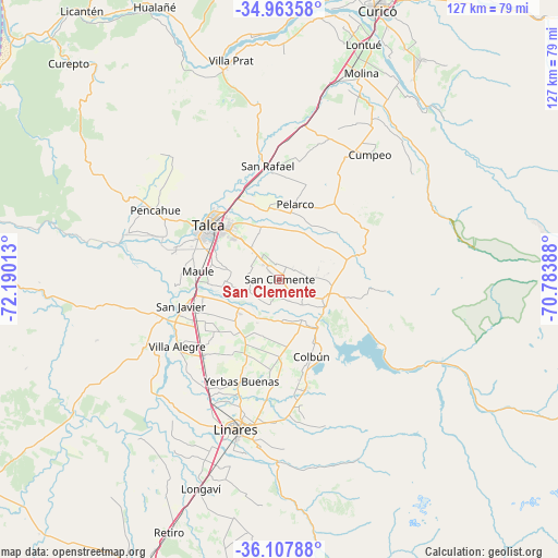
San Clemente GPS coordinates[2]
35° 32' 15.972" South, 71° 29' 13.2" West
| Map corner | latitude | longitude |
|---|---|---|
| Upper-left | -34.96358°, | -72.19013° |
| Center: | -35.53777°, | -71.487° |
| Lower-right: | -36.10788°, | -70.78388° |
| Map W x H: | 127.2×127.2 km | = 79×79mi |
| max Lat: | -18.19821° ⇑46.2% North |
| San Clemente: | -35.53777° |
| min Lat: | ⇓53.8% South -54.93355° |
| min Long | San Clemente | max Long |
| -109.42438° | -71.487° | -67.60963° |
| W 55.9%⇐ | ⇒44.1% E |
Elevation
Elevation of San Clemente is 214 m = 702 ft, and this is 59 m = 194 ft below average elevation for this country.
| Max E: |
3544 m = 11627 ft | 37.9% |
| Avg. | 273 m = 896 ft | |
| San Clemente | 214 m = 702 ft | |
Min E: |
1 m = 3 ft | 62.1% |
See also: Chile elevation on elevation.city.
Geographical zone
San Clemente is located in South temperate zone (between Tropic of Capricorn and the Antarctic Circle). Distance of this Southern Tropic circle is 1345.5 km =836.1 mi to North.| Distance of | km | miles | from San Clemente |
|---|---|---|---|
| Equator | 3951.4 | 2455.3 | to North |
| Tropic Capricorn | 1345.5 | 836.1 | to North |
| Antarctic Circle | 3449.7 | 2143.5 | to South |
| South Pole | 6055.6 | 3762.8 | to South |


Nearby cities:
15 places around San Clemente: (largest is in red/bold)
• Cauquenes
89.2 km =55.4 mi,  237°
237°
• Chimbarongo
100.2 km =62.3 mi,  23°
23°
• Colbún
19 km =11.8 mi,  157°
157°
• Constitución
86.8 km =53.9 mi,  285°
285°
• Curicó
65.7 km =40.8 mi, 20°
• Linares
35.7 km =22.2 mi,  195°
195°
• Longaví
50.7 km =31.5 mi, 200°
• Molina
50.6 km =31.4 mi, 21°
• Parral
73.9 km =45.9 mi, 204°
• Rauco
69.8 km =43.4 mi,  12°
12°
• San Carlos
107.3 km =66.7 mi, 203°
• San Javier
22.8 km =14.2 mi,  253°
253°
• Santa Cruz
100.6 km =62.5 mi, 6°
• Talca
19.6 km =12.2 mi,  309°
309°
• Teno
79.8 km =49.6 mi, 21°
Sources, notices
• [Note1] Compared only with cities in Chile existing in our database
• [Src1] Map data: © OpenStreetMap contributors (CC-BY-SA)
• [Src2] Other city data from geonames.org with taken over terms of usage.
• [Src3] Geographical zone / Annual Mean Temperature by Robert A. Rohde @ Wikipedia
