Quirihue geodata
Quirihue (Ñuble) is a seat of a second-order administrative division; located in Chile in America/Santiago (GMT-4) time zone. With population of 8,000 people, there are 113 cities with bigger population in this country. Compared to other cities in Chile, 51% of cities are located further ↑North; 67.6% of cities are located further →East and 71% of cities have lower elevation than Quirihue. Note1


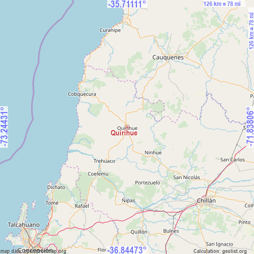
Quirihue GPS coordinates[2]
36° 16' 47.928" South, 72° 32' 28.248" West
| Map corner | latitude | longitude |
|---|---|---|
| Upper-left | -35.71111°, | -73.24431° |
| Center: | -36.27998°, | -72.54118° |
| Lower-right: | -36.84473°, | -71.83806° |
| Map W x H: | 126×126 km | = 78.3×78.3mi |
| max Lat: | -18.19821° ⇑51% North |
| Quirihue: | -36.27998° |
| min Lat: | ⇓49% South -54.93355° |
| min Long | Quirihue | max Long |
| -109.42438° | -72.54118° | -67.60963° |
| W 32.4%⇐ | ⇒67.6% E |
Elevation
Elevation of Quirihue is 262 m = 860 ft, and this is 11 m = 36 ft below average elevation for this country.
| Max E: |
3544 m = 11627 ft | 29% |
| Avg. | 273 m = 896 ft | |
| Quirihue | 262 m = 860 ft | |
Min E: |
1 m = 3 ft | 71% |
See also: Chile elevation on elevation.city.
Geographical zone
Quirihue is located in South temperate zone (between Tropic of Capricorn and the Antarctic Circle). Distance of this Southern Tropic circle is 1428 km =887.3 mi to North.| Distance of | km | miles | from Quirihue |
|---|---|---|---|
| Equator | 4034 | 2506.6 | to North |
| Tropic Capricorn | 1428 | 887.3 | to North |
| Antarctic Circle | 3367.2 | 2092.3 | to South |
| South Pole | 5973.1 | 3711.5 | to South |


Nearby cities:
15 places around Quirihue: (largest is in red/bold)
• Bulnes
55.8 km =34.7 mi,  157°
157°
• Cabrero
84.7 km =52.6 mi,  171°
171°
• Cauquenes
40 km =24.9 mi,  29°
29°
• Chiguayante
83.9 km =52.1 mi,  211°
211°
• Chillán
53.4 km =33.2 mi,  132°
132°
• Coihueco
74.4 km =46.2 mi,  121°
121°
• Concepción
75.9 km =47.2 mi,  216°
216°
• Linares
97.9 km =60.8 mi,  60°
60°
• Longaví
84.6 km =52.6 mi,  65°
65°
• Parral
65.9 km =40.9 mi,  76°
76°
• Penco
65.4 km =40.6 mi, 218°
• San Carlos
54.6 km =33.9 mi,  107°
107°
• Talcahuano
71.4 km =44.4 mi,  226°
226°
• Tomé
52.8 km =32.8 mi, 224°
• Yumbel
91 km =56.5 mi,  181°
181°
Sources, notices
• [Note1] Compared only with cities in Chile existing in our database
• [Src1] Map data: © OpenStreetMap contributors (CC-BY-SA)
• [Src2] Other city data from geonames.org with taken over terms of usage.
• [Src3] Geographical zone / Annual Mean Temperature by Robert A. Rohde @ Wikipedia
