Dawukou geodata
Dawukou (Ningxia Hui Autonomous Region) is a populated place; located in China in Asia/Shanghai (GMT+8) time zone. With population of 131,880 people, there are 331 cities with bigger population in this country. Compared to other cities in China, 82.9% of cities are located further ↓South; 85.5% of cities are located further →East and 87.1% of cities have lower elevation than Dawukou. Note1


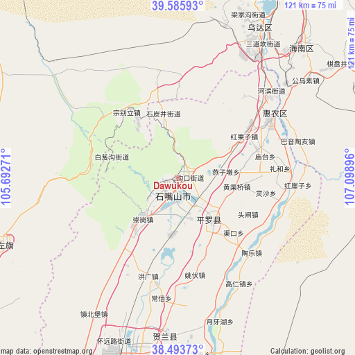
Dawukou GPS coordinates[2]
39° 2' 30.984" North, 106° 23' 44.988" East
| Map corner | latitude | longitude |
|---|---|---|
| Upper-left | 39.58593°, | 105.69271° |
| Center: | 39.04194°, | 106.39583° |
| Lower-right: | 38.49373°, | 107.09896° |
| Map W x H: | 121.4×121.4 km | = 75.4×75.4mi |
| max Lat: | 53.31946° ⇑17.1% North |
| Dawukou: | 39.04194° |
| min Lat: | ⇓82.9% South 18.22056° |
| min Long | Dawukou | max Long |
| 75.07348° | 106.39583° | 134.28917° |
| W 14.5%⇐ | ⇒85.5% E |
Elevation
Elevation of Dawukou is 1119 m = 3671 ft, and this is 634.2 m = 2081 ft above average elevation for this country.
| Max E: |
5622 m = 18445 ft | 12.9% |
| Dawukou | 1119 m 3671 ft | |
| Avg. | 484.8 m = 1591 ft | |
Min E: |
-3 m = -10 ft | 87.1% |
See also: Dawukou elevation on elevation.city.
Geographical zone
Dawukou is located in North temperate zone (between Tropic of Cancer and the Arctic Circle). Distance of this Northern Tropic circle is 1735.1 km =1078.1 mi to South.| Distance of | km | miles | from Dawukou |
|---|---|---|---|
| North Pole | 5666 | 3520.7 | to North |
| Arctic Circle | 3060.1 | 1901.5 | to North |
| Tropic Cancer | 1735.1 | 1078.1 | to South |
| Equator | 4341.1 | 2697.4 | to South |


Nearby cities:
15 places around Dawukou: (largest is in red/bold)
• Bayan Hot
66.8 km =41.5 mi,  250°
250°
• Bayinsai
58.1 km =36.1 mi,  28°
28°
• Beijie
37.7 km =23.4 mi,  57°
57°
• Dongta
106.9 km =66.4 mi,  182°
182°
• Lasengmiao
49.1 km =30.5 mi,  50°
50°
• Pingluo Chengguanzhen
19.9 km =12.4 mi,  140°
140°
• Qabqir
75.9 km =47.2 mi, 32°
• Shitanjing
21.8 km =13.5 mi,  348°
348°
• Shizuishan
38.6 km =24 mi, 56°
• Wuda
57.7 km =35.9 mi, 28°
• Wuhai
80 km =49.7 mi, 26°
• Wuzhong
118.5 km =73.6 mi,  188°
188°
• Xigang
54.6 km =33.9 mi, 184°
• Yanghe
85.9 km =53.4 mi, 188°
• Yinchuan
64.7 km =40.2 mi, 189°
Sources, notices
• [Note1] Compared only with cities in China existing in our database
• [Src1] Map data: © OpenStreetMap contributors (CC-BY-SA)
• [Src2] Other city data from geonames.org with taken over terms of usage.
• [Src3] Geographical zone / Annual Mean Temperature by Robert A. Rohde @ Wikipedia
