Wuhai geodata
Wuhai (Inner Mongolia) is a seat of a second-order administrative division; located in China in Asia/Shanghai (GMT+8) time zone. With population of 218,427 people, there are 218 cities with bigger population in this country. Compared to other cities in China, 85.3% of cities are located further ↓South; 84.2% of cities are located further →East and 86.7% of cities have lower elevation than Wuhai. Note1


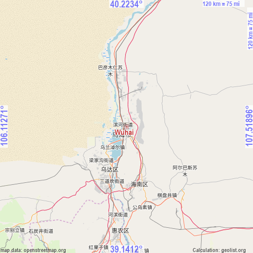
Wuhai GPS coordinates[2]
39° 41' 3.912" North, 106° 48' 56.988" East
| Map corner | latitude | longitude |
|---|---|---|
| Upper-left | 40.2234°, | 106.11271° |
| Center: | 39.68442°, | 106.81583° |
| Lower-right: | 39.1412°, | 107.51896° |
| Map W x H: | 120.3×120.3 km | = 74.8×74.8mi |
| max Lat: | 53.31946° ⇑14.7% North |
| Wuhai: | 39.68442° |
| min Lat: | ⇓85.3% South 18.22056° |
| min Long | Wuhai | max Long |
| 75.07348° | 106.81583° | 134.28917° |
| W 15.8%⇐ | ⇒84.2% E |
Elevation
Elevation of Wuhai is 1096 m = 3596 ft, and this is 611.2 m = 2005 ft above average elevation for this country.
| Max E: |
5622 m = 18445 ft | 13.3% |
| Wuhai | 1096 m 3596 ft | |
| Avg. | 484.8 m = 1591 ft | |
Min E: |
-3 m = -10 ft | 86.7% |
See also: Wuhai elevation on elevation.city.
Geographical zone
Wuhai is located in North temperate zone (between Tropic of Cancer and the Arctic Circle). Distance of this Northern Tropic circle is 1806.6 km =1122.6 mi to South.| Distance of | km | miles | from Wuhai |
|---|---|---|---|
| North Pole | 5594.6 | 3476.3 | to North |
| Arctic Circle | 2988.7 | 1857.1 | to North |
| Tropic Cancer | 1806.6 | 1122.6 | to South |
| Equator | 4412.5 | 2741.8 | to South |


Nearby cities:
15 places around Wuhai: (largest is in red/bold)
• Bayan Gol
69.9 km =43.4 mi,  11°
11°
• Bayan Hot
136.4 km =84.8 mi,  226°
226°
• Bayan Nur
127.1 km =79 mi,  22°
22°
• Bayinsai
22.1 km =13.7 mi,  201°
201°
• Beijie
51.5 km =32 mi,  184°
184°
• Dawukou
80 km =49.7 mi,  206°
206°
• Lasengmiao
40.2 km =25 mi, 177°
• Pingluo Chengguanzhen
90 km =55.9 mi, 195°
• Qabqir
9.1 km =5.7 mi,  146°
146°
• Shitanjing
64.4 km =40 mi,  218°
218°
• Shizuishan
50.3 km =31.3 mi, 184°
• Ulan
119.7 km =74.4 mi,  123°
123°
• Wuda
22.4 km =13.9 mi, 203°
• Xamba
136.3 km =84.7 mi, 11°
• Xigang
132.2 km =82.1 mi, 197°
Sources, notices
• [Note1] Compared only with cities in China existing in our database
• [Src1] Map data: © OpenStreetMap contributors (CC-BY-SA)
• [Src2] Other city data from geonames.org with taken over terms of usage.
• [Src3] Geographical zone / Annual Mean Temperature by Robert A. Rohde @ Wikipedia
