Bayan Hot geodata
Bayan Hot (Inner Mongolia) is a seat of a third-order administrative division; located in China in Asia/Shanghai (GMT+8) time zone. In our database, there are 1268 cities with bigger population. Compared to other cities in China, 82.4% of cities are located further ↓South; 87.9% of cities are located further →East and 91.6% of cities have lower elevation than Bayan Hot. Note1


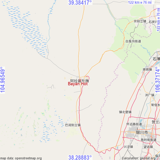
Bayan Hot GPS coordinates[2]
38° 50' 18.996" North, 105° 40' 6.996" East
| Map corner | latitude | longitude |
|---|---|---|
| Upper-left | 39.38417°, | 104.96549° |
| Center: | 38.83861°, | 105.66861° |
| Lower-right: | 38.28883°, | 106.37174° |
| Map W x H: | 121.8×121.8 km | = 75.7×75.7mi |
| max Lat: | 53.31946° ⇑17.6% North |
| Bayan Hot: | 38.83861° |
| min Lat: | ⇓82.4% South 18.22056° |
| min Long | Bayan Hot | max Long |
| 75.07348° | 105.66861° | 134.28917° |
| W 12.1%⇐ | ⇒87.9% E |
Elevation
Elevation of Bayan Hot is 1529 m = 5016 ft, and this is 1044.2 m = 3426 ft above average elevation for this country.
| Max E: |
5622 m = 18445 ft | 8.4% |
| Bayan Hot | 1529 m 5016 ft | |
| Avg. | 484.8 m = 1591 ft | |
Min E: |
-3 m = -10 ft | 91.6% |
See also: China elevation on elevation.city.
Geographical zone
Bayan Hot is located in North temperate zone (between Tropic of Cancer and the Arctic Circle). Distance of this Northern Tropic circle is 1712.5 km =1064.1 mi to South.| Distance of | km | miles | from Bayan Hot |
|---|---|---|---|
| North Pole | 5688.6 | 3534.7 | to North |
| Arctic Circle | 3082.7 | 1915.5 | to North |
| Tropic Cancer | 1712.5 | 1064.1 | to South |
| Equator | 4318.4 | 2683.3 | to South |


Nearby cities:
15 places around Bayan Hot: (largest is in red/bold)
• Bayinsai
116.7 km =72.5 mi,  50°
50°
• Beijie
103.9 km =64.6 mi,  65°
65°
• Dawukou
66.8 km =41.5 mi, 70°
• Dongta
102.7 km =63.8 mi,  145°
145°
• Lasengmiao
114.2 km =71 mi,  61°
61°
• Pingluo Chengguanzhen
75.9 km =47.2 mi,  84°
84°
• Qabqir
135.1 km =83.9 mi, 50°
• Shengli
105.5 km =65.6 mi, 154°
• Shitanjing
73 km =45.4 mi, 52°
• Shizuishan
104.7 km =65.1 mi, 65°
• Wuda
116.1 km =72.1 mi, 50°
• Wuzhong
105.5 km =65.6 mi, 153°
• Xigang
67 km =41.6 mi,  118°
118°
• Yanghe
80.1 km =49.8 mi,  141°
141°
• Yinchuan
66.7 km =41.4 mi,  128°
128°
Sources, notices
• [Note1] Compared only with cities in China existing in our database
• [Src1] Map data: © OpenStreetMap contributors (CC-BY-SA)
• [Src2] Other city data from geonames.org with taken over terms of usage.
• [Src3] Geographical zone / Annual Mean Temperature by Robert A. Rohde @ Wikipedia
