Lasengmiao geodata
Lasengmiao (Inner Mongolia) is a seat of a fourth-order administrative division; located in China in Asia/Shanghai (GMT+8) time zone. In our database, there are 1268 cities with bigger population. Compared to other cities in China, 84.2% of cities are located further ↓South; 84.1% of cities are located further →East and 87.3% of cities have lower elevation than Lasengmiao. Note1


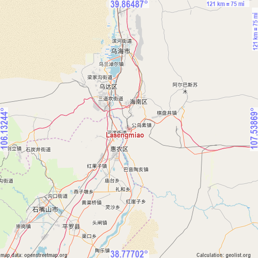
Lasengmiao GPS coordinates[2]
39° 19' 23.016" North, 106° 50' 8.016" East
| Map corner | latitude | longitude |
|---|---|---|
| Upper-left | 39.86487°, | 106.13244° |
| Center: | 39.32306°, | 106.83556° |
| Lower-right: | 38.77702°, | 107.53869° |
| Map W x H: | 121×121 km | = 75.2×75.2mi |
| max Lat: | 53.31946° ⇑15.8% North |
| Lasengmiao: | 39.32306° |
| min Lat: | ⇓84.2% South 18.22056° |
| min Long | Lasengmiao | max Long |
| 75.07348° | 106.83556° | 134.28917° |
| W 15.9%⇐ | ⇒84.1% E |
Elevation
Elevation of Lasengmiao is 1135 m = 3724 ft, and this is 650.2 m = 2133 ft above average elevation for this country.
| Max E: |
5622 m = 18445 ft | 12.7% |
| Lasengmiao | 1135 m 3724 ft | |
| Avg. | 484.8 m = 1591 ft | |
Min E: |
-3 m = -10 ft | 87.3% |
See also: China elevation on elevation.city.
Geographical zone
Lasengmiao is located in North temperate zone (between Tropic of Cancer and the Arctic Circle). Distance of this Northern Tropic circle is 1766.4 km =1097.6 mi to South.| Distance of | km | miles | from Lasengmiao |
|---|---|---|---|
| North Pole | 5634.7 | 3501.2 | to North |
| Arctic Circle | 3028.9 | 1882.1 | to North |
| Tropic Cancer | 1766.4 | 1097.6 | to South |
| Equator | 4372.3 | 2716.8 | to South |


Nearby cities:
15 places around Lasengmiao: (largest is in red/bold)
• Bayan Gol
109.4 km =68 mi,  6°
6°
• Bayan Hot
114.2 km =71 mi,  241°
241°
• Bayinsai
22.1 km =13.7 mi,  333°
333°
• Beijie
12.7 km =7.9 mi,  208°
208°
• Dawukou
49.1 km =30.5 mi,  230°
230°
• Pingluo Chengguanzhen
53.1 km =33 mi, 208°
• Qabqir
32.7 km =20.3 mi, 5°
• Shitanjing
43.5 km =27 mi,  256°
256°
• Shizuishan
11.5 km =7.1 mi, 209°
• Ulan
101.9 km =63.3 mi,  104°
104°
• Wuda
22.3 km =13.9 mi, 331°
• Wuhai
40.2 km =25 mi,  357°
357°
• Xigang
95.5 km =59.3 mi, 206°
• Yanghe
126.8 km =78.8 mi,  203°
203°
• Yinchuan
106.8 km =66.4 mi, 207°
Sources, notices
• [Note1] Compared only with cities in China existing in our database
• [Src1] Map data: © OpenStreetMap contributors (CC-BY-SA)
• [Src2] Other city data from geonames.org with taken over terms of usage.
• [Src3] Geographical zone / Annual Mean Temperature by Robert A. Rohde @ Wikipedia
