Beijie geodata
Beijie (Ningxia Hui Autonomous Region) is a seat of a third-order administrative division; located in China in Asia/Shanghai (GMT+8) time zone. In our database, there are 1268 cities with bigger population. Compared to other cities in China, 83.8% of cities are located further ↓South; 84.4% of cities are located further →East and 86.7% of cities have lower elevation than Beijie. Note1


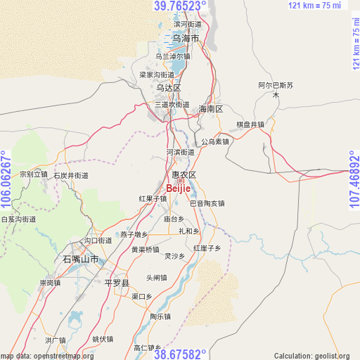
Beijie GPS coordinates[2]
39° 13' 21.504" North, 106° 45' 56.844" East
| Map corner | latitude | longitude |
|---|---|---|
| Upper-left | 39.76523°, | 106.06267° |
| Center: | 39.22264°, | 106.76579° |
| Lower-right: | 38.67582°, | 107.46892° |
| Map W x H: | 121.1×121.1 km | = 75.2×75.2mi |
| max Lat: | 53.31946° ⇑16.2% North |
| Beijie: | 39.22264° |
| min Lat: | ⇓83.8% South 18.22056° |
| min Long | Beijie | max Long |
| 75.07348° | 106.76579° | 134.28917° |
| W 15.6%⇐ | ⇒84.4% E |
Elevation
Elevation of Beijie is 1094 m = 3589 ft, and this is 609.2 m = 1999 ft above average elevation for this country.
| Max E: |
5622 m = 18445 ft | 13.3% |
| Beijie | 1094 m 3589 ft | |
| Avg. | 484.8 m = 1591 ft | |
Min E: |
-3 m = -10 ft | 86.7% |
See also: China elevation on elevation.city.
Geographical zone
Beijie is located in North temperate zone (between Tropic of Cancer and the Arctic Circle). Distance of this Northern Tropic circle is 1755.2 km =1090.6 mi to South.| Distance of | km | miles | from Beijie |
|---|---|---|---|
| North Pole | 5645.9 | 3508.2 | to North |
| Arctic Circle | 3040 | 1889 | to North |
| Tropic Cancer | 1755.2 | 1090.6 | to South |
| Equator | 4361.1 | 2709.9 | to South |


Nearby cities:
15 places around Beijie: (largest is in red/bold)
• Bayan Gol
121.2 km =75.3 mi,  8°
8°
• Bayan Hot
103.9 km =64.6 mi,  245°
245°
• Bayinsai
31.1 km =19.3 mi,  352°
352°
• Dawukou
37.7 km =23.4 mi,  237°
237°
• Lasengmiao
12.7 km =7.9 mi,  28°
28°
• Pingluo Chengguanzhen
40.4 km =25.1 mi,  208°
208°
• Qabqir
44.7 km =27.8 mi, 11°
• Shitanjing
36.4 km =22.6 mi,  272°
272°
• Shizuishan
1.2 km =0.7 mi, 14°
• Ulan
105.7 km =65.7 mi,  97°
97°
• Wuda
31.1 km =19.3 mi, 351°
• Wuhai
51.5 km =32 mi,  4°
4°
• Xigang
82.8 km =51.4 mi, 205°
• Yanghe
114.2 km =71 mi,  203°
203°
• Yinchuan
94.1 km =58.5 mi, 206°
Sources, notices
• [Note1] Compared only with cities in China existing in our database
• [Src1] Map data: © OpenStreetMap contributors (CC-BY-SA)
• [Src2] Other city data from geonames.org with taken over terms of usage.
• [Src3] Geographical zone / Annual Mean Temperature by Robert A. Rohde @ Wikipedia
