Shitanjing geodata
Shitanjing (Ningxia Hui Autonomous Region) is a populated place; located in China in Asia/Shanghai (GMT+8) time zone. With population of 78,765 people, there are 542 cities with bigger population in this country. Compared to other cities in China, 83.8% of cities are located further ↓South; 85.7% of cities are located further →East and 90.7% of cities have lower elevation than Shitanjing. Note1


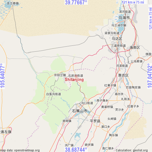
Shitanjing GPS coordinates[2]
39° 14' 3.012" North, 106° 20' 38.004" East
| Map corner | latitude | longitude |
|---|---|---|
| Upper-left | 39.77667°, | 105.64077° |
| Center: | 39.23417°, | 106.34389° |
| Lower-right: | 38.68744°, | 107.04702° |
| Map W x H: | 121.1×121.1 km | = 75.2×75.2mi |
| max Lat: | 53.31946° ⇑16.2% North |
| Shitanjing: | 39.23417° |
| min Lat: | ⇓83.8% South 18.22056° |
| min Long | Shitanjing | max Long |
| 75.07348° | 106.34389° | 134.28917° |
| W 14.3%⇐ | ⇒85.7% E |
Elevation
Elevation of Shitanjing is 1428 m = 4685 ft, and this is 943.2 m = 3094 ft above average elevation for this country.
| Max E: |
5622 m = 18445 ft | 9.3% |
| Shitanjing | 1428 m 4685 ft | |
| Avg. | 484.8 m = 1591 ft | |
Min E: |
-3 m = -10 ft | 90.7% |
See also: Shitanjing elevation on elevation.city.
Geographical zone
Shitanjing is located in North temperate zone (between Tropic of Cancer and the Arctic Circle). Distance of this Northern Tropic circle is 1756.5 km =1091.4 mi to South.| Distance of | km | miles | from Shitanjing |
|---|---|---|---|
| North Pole | 5644.6 | 3507.4 | to North |
| Arctic Circle | 3038.7 | 1888.2 | to North |
| Tropic Cancer | 1756.5 | 1091.4 | to South |
| Equator | 4362.4 | 2710.7 | to South |


Nearby cities:
15 places around Shitanjing: (largest is in red/bold)
• Bayan Gol
130.5 km =81.1 mi,  24°
24°
• Bayan Hot
73 km =45.4 mi,  232°
232°
• Bayinsai
43.8 km =27.2 mi,  47°
47°
• Beijie
36.4 km =22.6 mi,  92°
92°
• Dawukou
21.8 km =13.5 mi,  168°
168°
• Dongta
128.2 km =79.7 mi,  179°
179°
• Lasengmiao
43.5 km =27 mi,  76°
76°
• Pingluo Chengguanzhen
40.5 km =25.2 mi,  155°
155°
• Qabqir
62.2 km =38.6 mi, 46°
• Shizuishan
36.7 km =22.8 mi, 90°
• Wuda
43.2 km =26.8 mi, 46°
• Wuhai
64.4 km =40 mi,  38°
38°
• Xigang
75.8 km =47.1 mi, 179°
• Yanghe
106.6 km =66.2 mi, 184°
• Yinchuan
85.4 km =53.1 mi, 184°
Sources, notices
• [Note1] Compared only with cities in China existing in our database
• [Src1] Map data: © OpenStreetMap contributors (CC-BY-SA)
• [Src2] Other city data from geonames.org with taken over terms of usage.
• [Src3] Geographical zone / Annual Mean Temperature by Robert A. Rohde @ Wikipedia
