Zangkaxa geodata
Zangkaxa (Tibet) is a seat of a fourth-order administrative division; located in China in Asia/Shanghai (GMT+8) time zone. In our database, there are 1268 cities with bigger population. Compared to other cities in China, 68.8% of cities are located further ↓South; 99.5% of cities are located further →East and 99.5% of cities have lower elevation than Zangkaxa. Note1


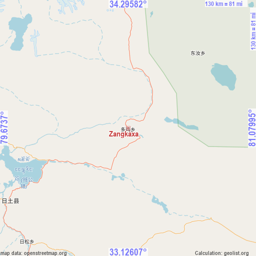
Zangkaxa GPS coordinates[2]
33° 42' 46.584" North, 80° 22' 36.552" East
| Map corner | latitude | longitude |
|---|---|---|
| Upper-left | 34.29582°, | 79.6737° |
| Center: | 33.71294°, | 80.37682° |
| Lower-right: | 33.12607°, | 81.07995° |
| Map W x H: | 130.1×130.1 km | = 80.8×80.8mi |
| max Lat: | 53.31946° ⇑31.2% North |
| Zangkaxa: | 33.71294° |
| min Lat: | ⇓68.8% South 18.22056° |
| min Long | Zangkaxa | max Long |
| 75.07348° | 80.37682° | 134.28917° |
| W 0.5%⇐ | ⇒99.5% E |
Elevation
Elevation of Zangkaxa is 4437 m = 14557 ft, and this is 3952.2 m = 12967 ft above average elevation for this country.
| Max E: |
5622 m = 18445 ft | 0.5% |
| Zangkaxa | 4437 m 14557 ft | |
| Avg. | 484.8 m = 1591 ft | |
Min E: |
-3 m = -10 ft | 99.5% |
See also: China elevation on elevation.city.
Geographical zone
Zangkaxa is located in North temperate zone (between Tropic of Cancer and the Arctic Circle). Distance of this Northern Tropic circle is 1142.6 km =710 mi to South.| Distance of | km | miles | from Zangkaxa |
|---|---|---|---|
| North Pole | 6258.5 | 3888.9 | to North |
| Arctic Circle | 3652.6 | 2269.6 | to North |
| Tropic Cancer | 1142.6 | 710 | to South |
| Equator | 3748.5 | 2329.2 | to South |


Nearby cities:
15 places around Zangkaxa: (largest is in red/bold)
• Darchen
321 km =199.5 mi,  164°
164°
• Diyag
268.1 km =166.6 mi,  213°
213°
• Gangsha
316 km =196.4 mi, 164°
• Gar
179.7 km =111.7 mi,  189°
189°
• Geji
162.8 km =101.2 mi,  154°
154°
• Jisegumen
53.4 km =33.2 mi,  42°
42°
• Langjiu
150.6 km =93.6 mi,  178°
178°
• Lumaka
69.7 km =43.3 mi, 180°
• Nur
297 km =184.5 mi,  12°
12°
• Qumudi
201.6 km =125.3 mi, 213°
• Rutog
75.8 km =47.1 mi,  244°
244°
• Shiquanhe
137.2 km =85.3 mi, 190°
• Toding
254.1 km =157.9 mi, 192°
• Xagmakajor
307.2 km =190.9 mi,  143°
143°
• Zhabu
279.6 km =173.7 mi,  103°
103°
Sources, notices
• [Note1] Compared only with cities in China existing in our database
• [Src1] Map data: © OpenStreetMap contributors (CC-BY-SA)
• [Src2] Other city data from geonames.org with taken over terms of usage.
• [Src3] Geographical zone / Annual Mean Temperature by Robert A. Rohde @ Wikipedia
